 |
Below you shall find drawings related to right-of-way and structires produced by SP company draftsmen, predominately for Coast and Western Division locations. Please feel free to use them for any non-commercial purpose. We only we request that you email a heads-up to us at wx4org@yahoo.com and give us a credit line stating Image Courtesy of Wx4.org.
|
||||
|
|
|||||
|
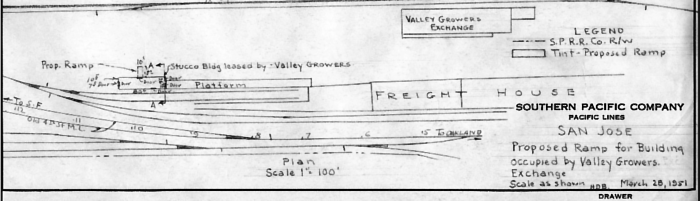
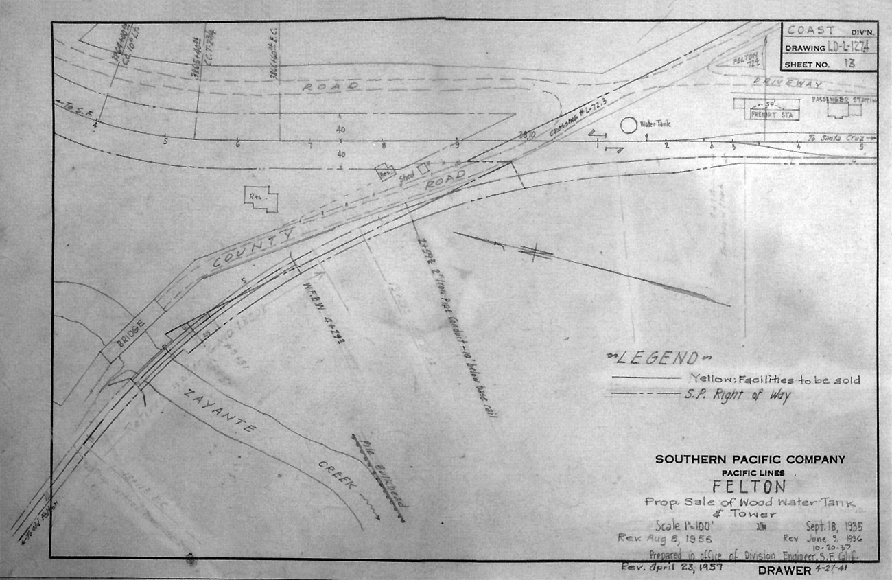
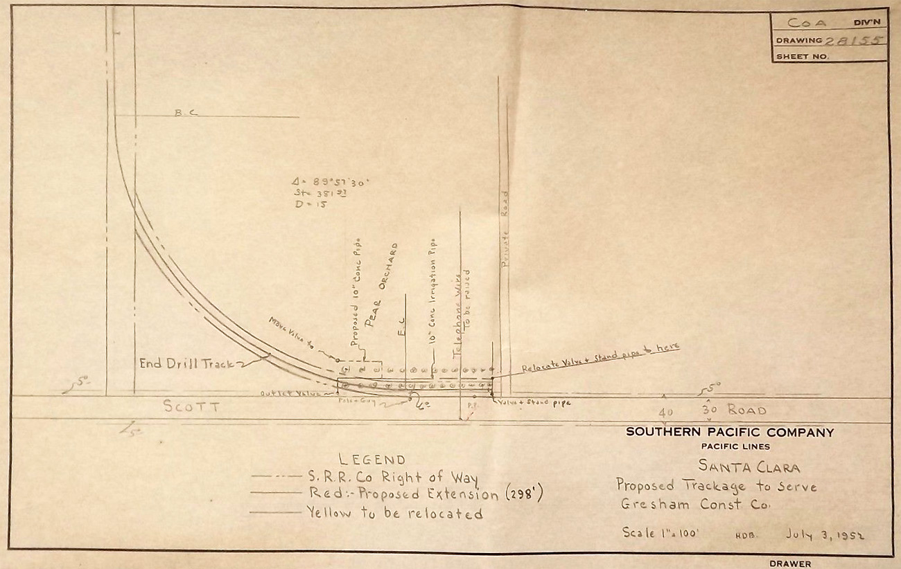
Wx4 has a page devoted to explaining these pamphlet-sized books that ground employees used to locate industries and car spots, along with accompanying PDF's of books for San Francisco, the Peninsula and the San Jose region. Follow the link above. Engineering Drawings The PDF files below externally and internally arranged by geographic locality, ordered north to south in the case of multiple cities. Many of the originals were drawn in pencil from blank forms, from copies of earlier drawings, or simply by erasing and drawing over earlier data. They were not colorized - only the subsequent copies made from them were hand-colored for specific purposes. Note that most these drawings were created for proposed construction, some of which never took place. Content variously includes both "maps" and floor plans. 4-30-24 NEW: Shasta Division engineering department
Western Division
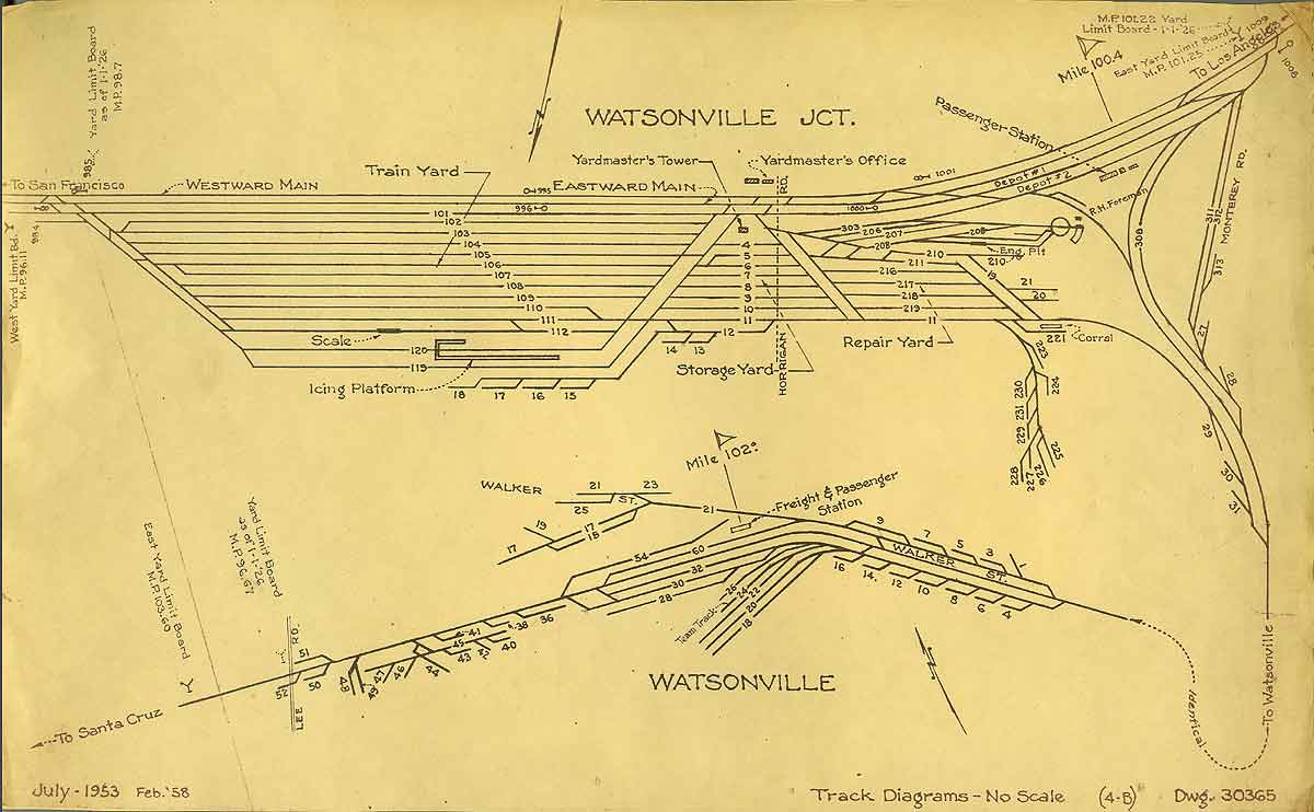
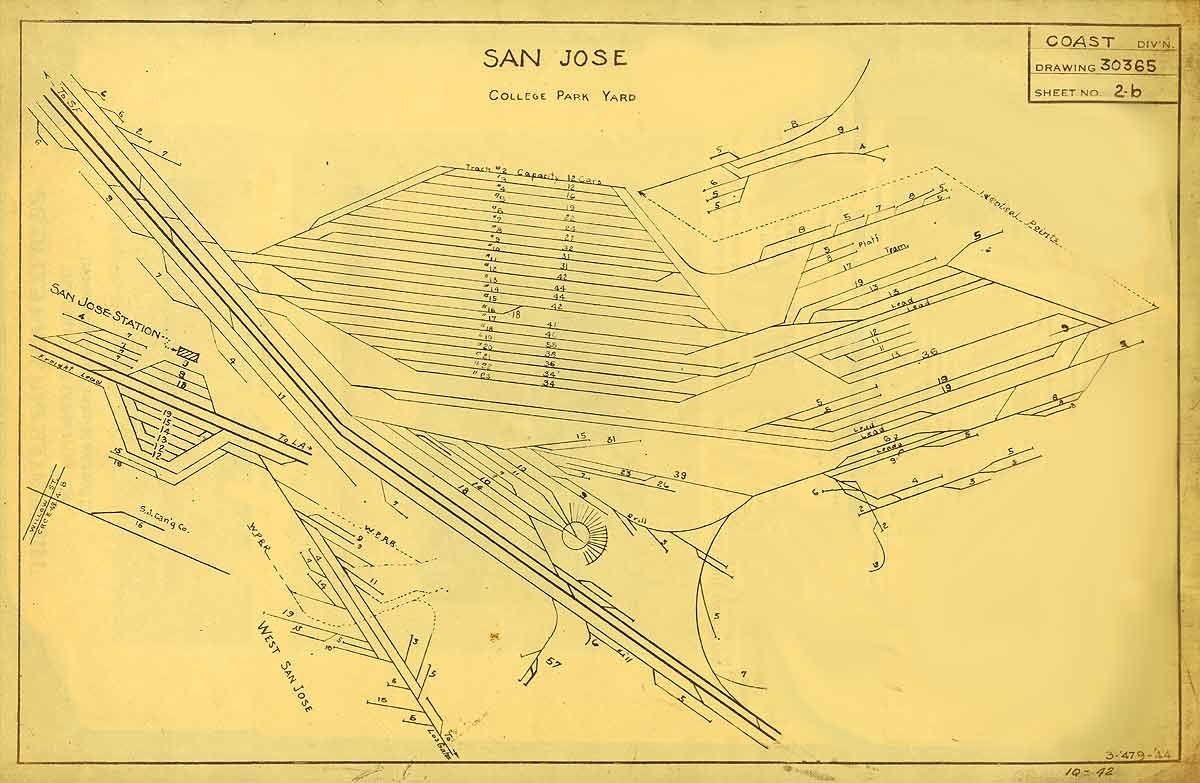
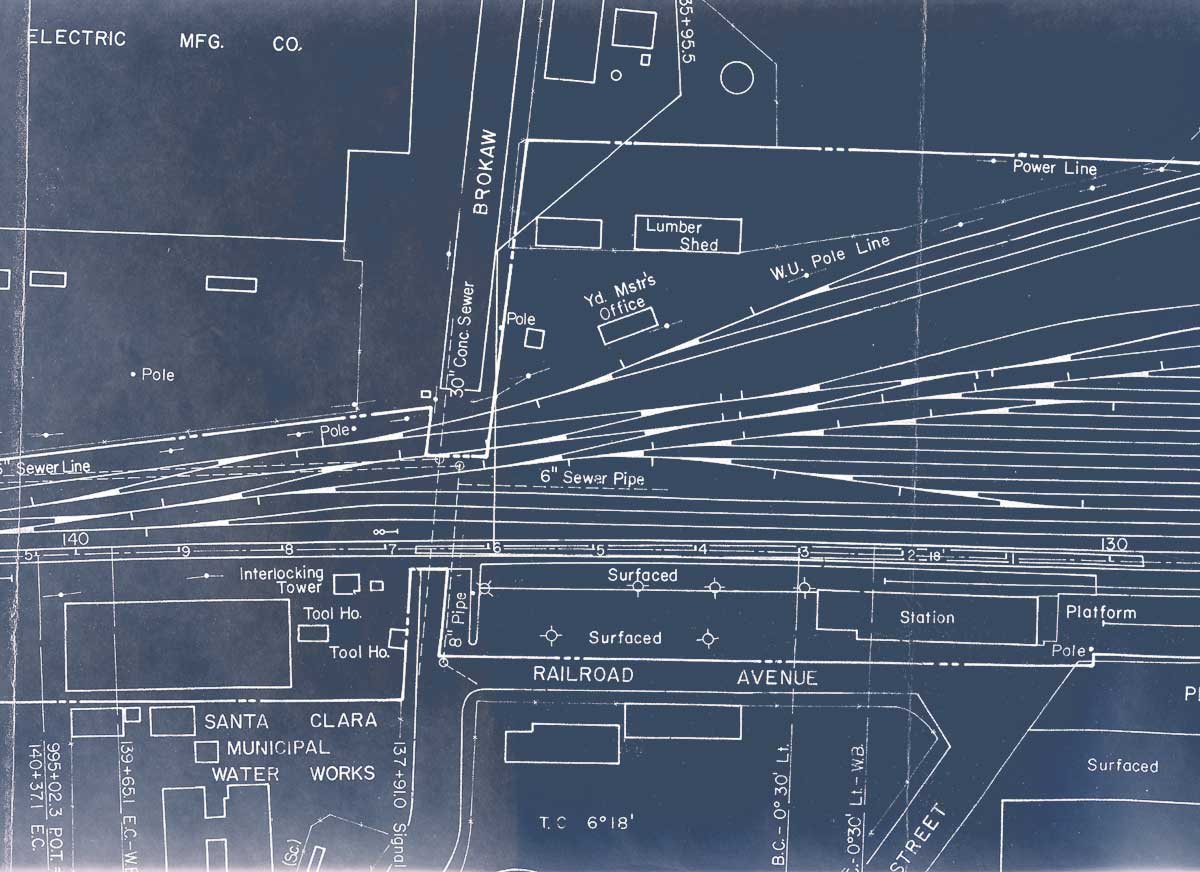
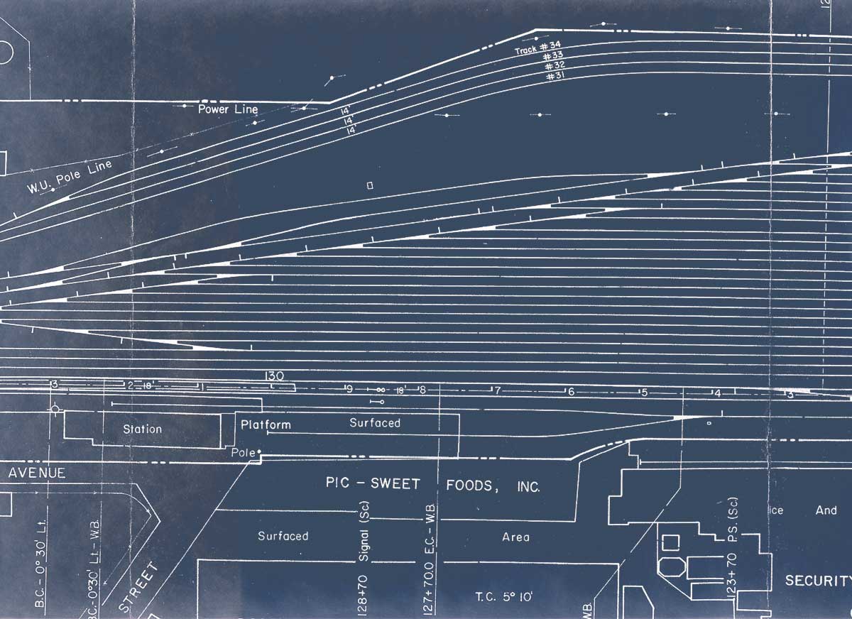
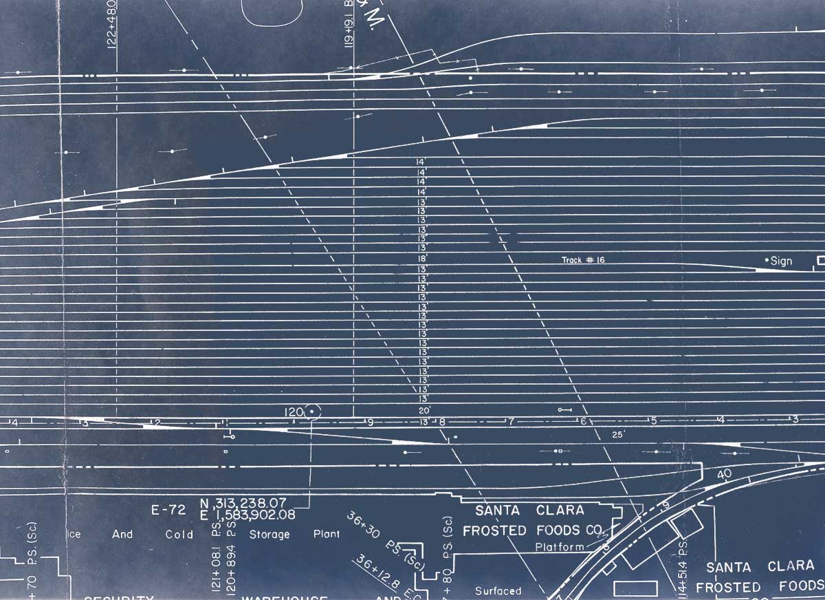
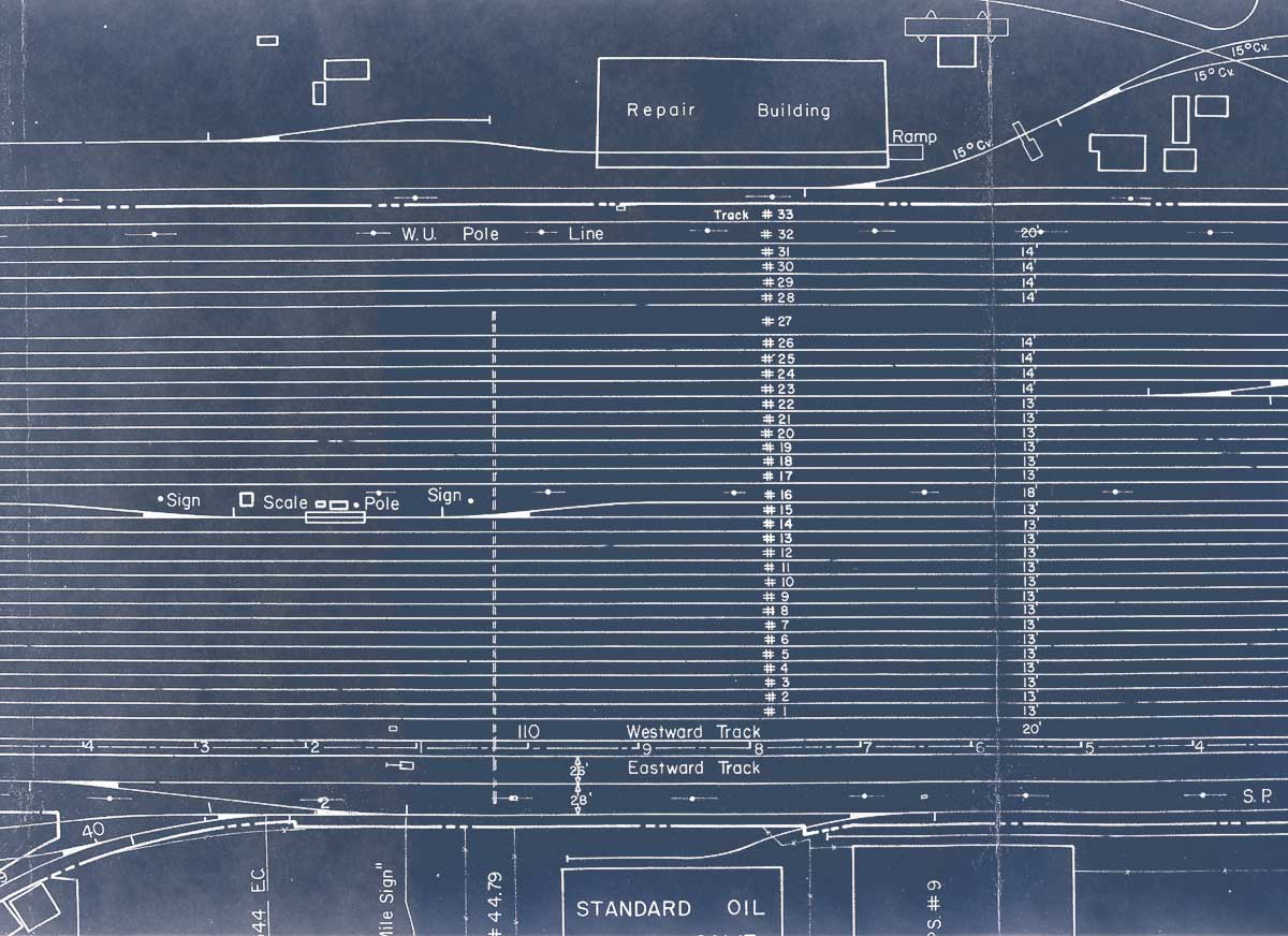
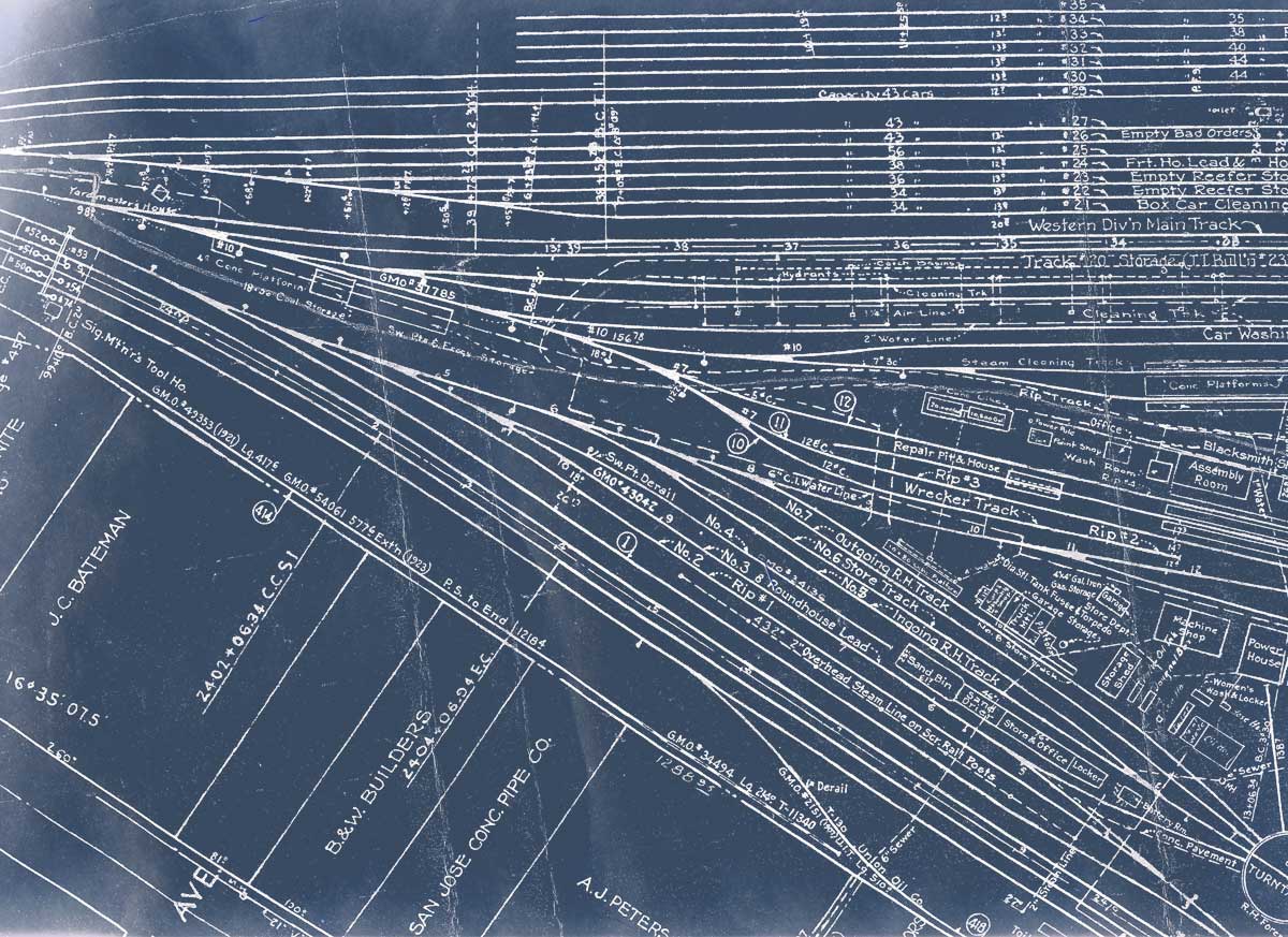
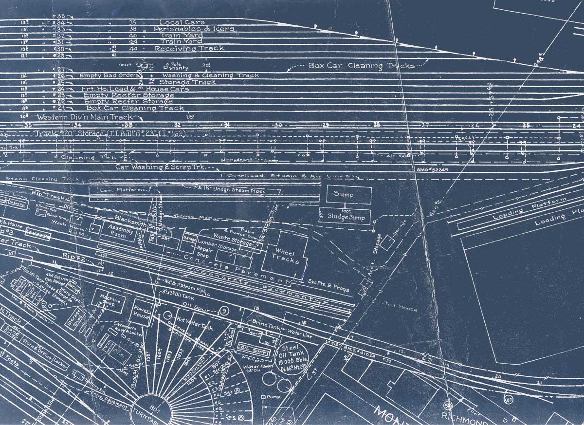
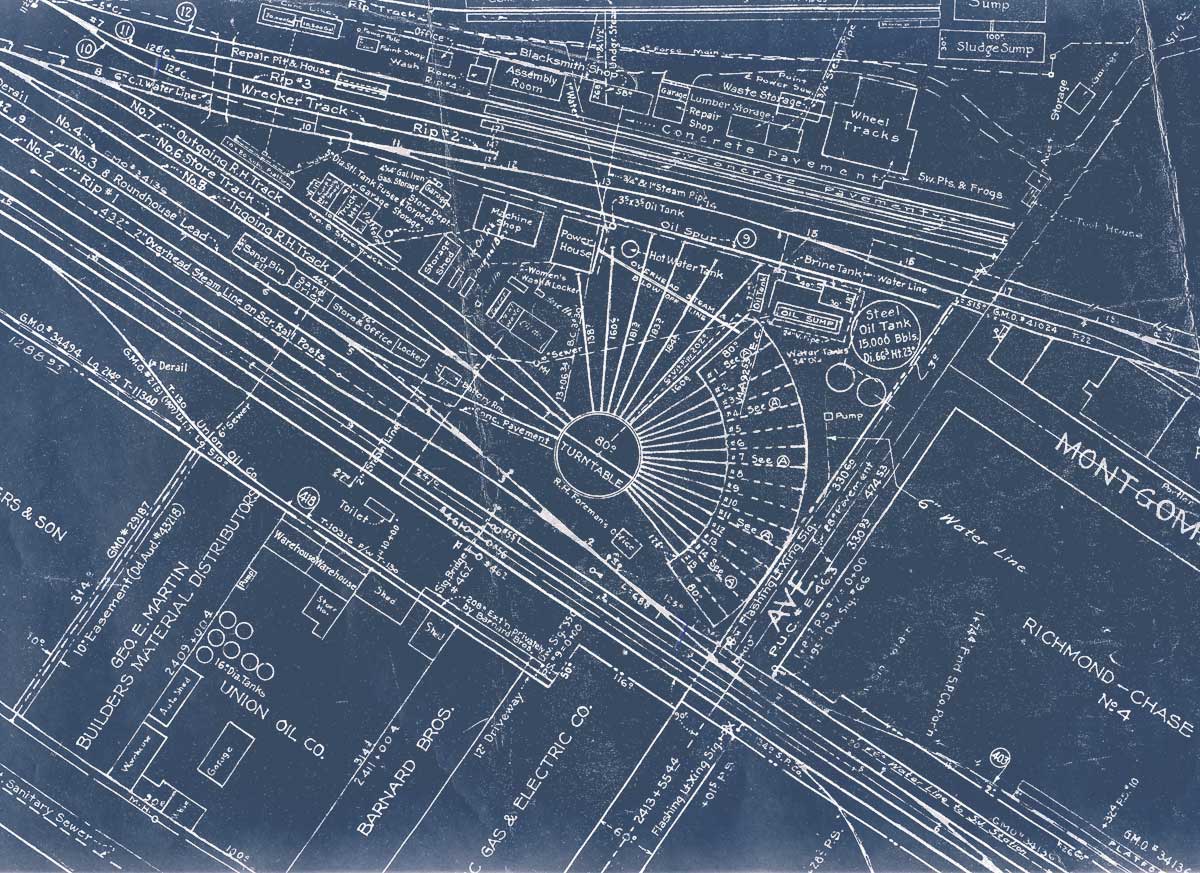
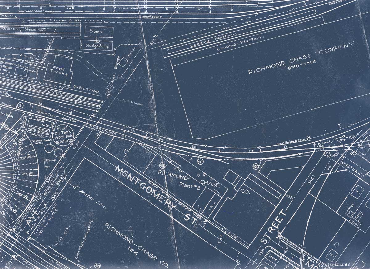
Robert Bowdidge's site on Flickr hosts 170+ of them. Robert, friend and kindred spirit, also believes that such valuable (and cool!) data ought to shared, not sat upon. By coincidence, Robert lives near Wx4 Summer Headquarters and out-bid us on eBay for his collection. We outbid him for ours. Small world. He also has a fine website that includes extensive hisories of Santa Clara County packing companies / modeling SP's Vasona Branch / his Blog These diagrams were referenced by rookie yardmasters to determine the car capacity on any given rail. Of course, any guy holding a yardmaster tag and worth his salt knew the REAL track capacities, and that these charts were "all wrong". Nevertheless, they're interesting snapshots-in-time of Coast Division terminal trackage, especially the San Jose maps when compared to the SPINS Zone Maps shown elsewhere. San Luis Obispo, July 1951 |
Structures
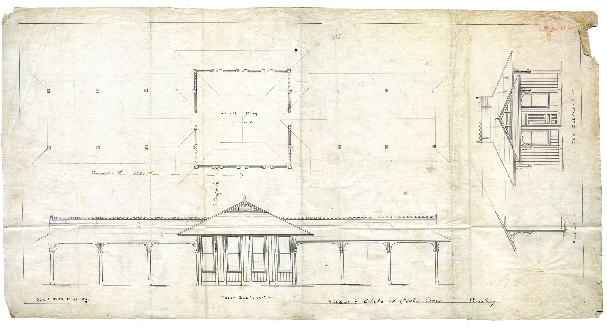
1900 Central Pacific San Jose Branch bridge replace- "Depot and sheds at Holy Cross Cemetery" pencil and ink Bayshore Roundhouse 1941 Turntable Plans |
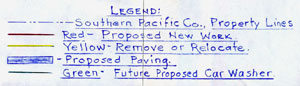
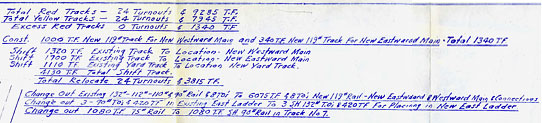
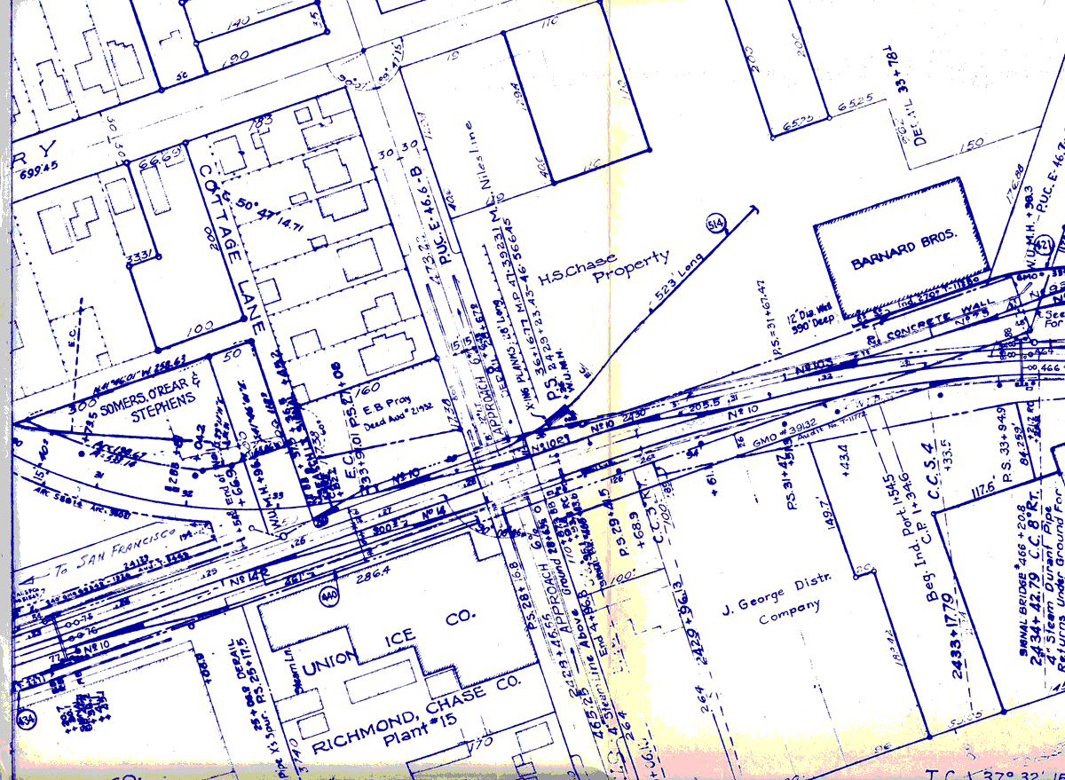
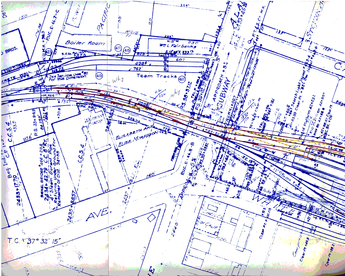
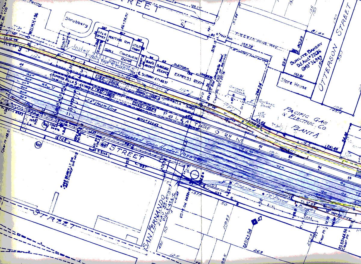
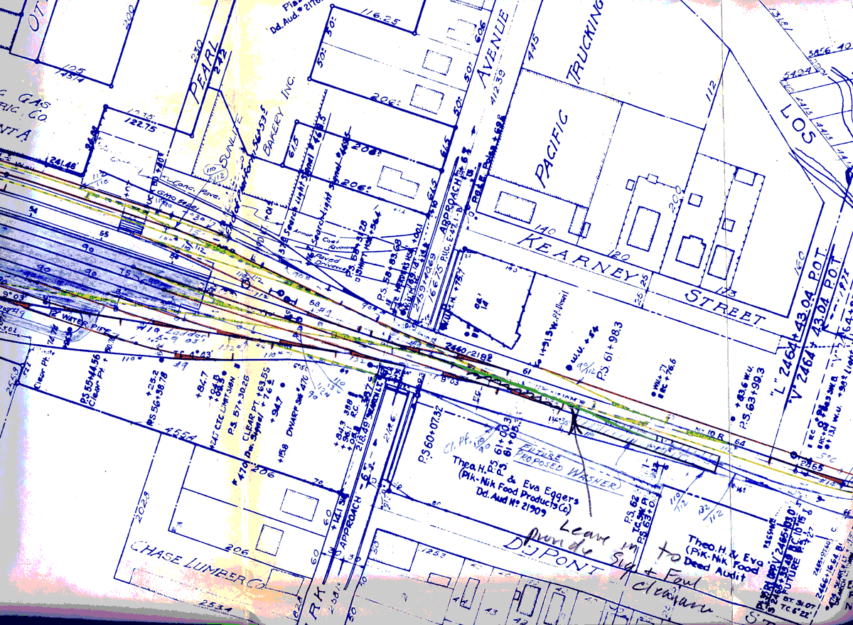
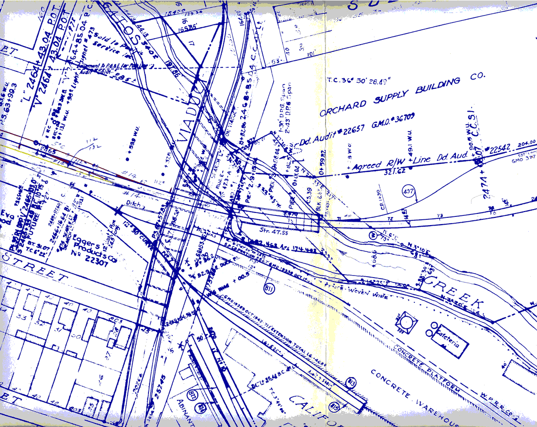
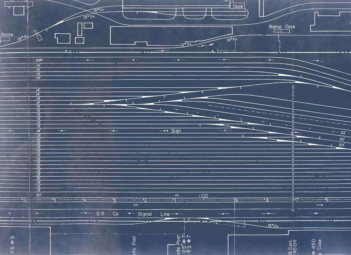
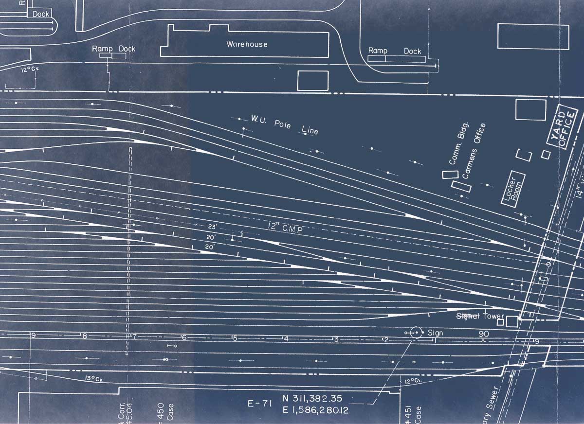
Cahill Depot, Proposed Trackage Re-Arrangement, 1965 Note: These images support a page about SP's San Jose traffic bottleneck
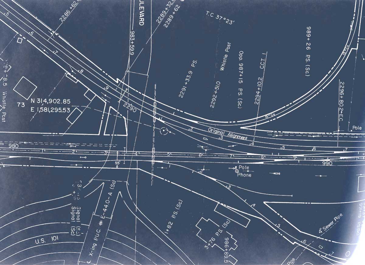
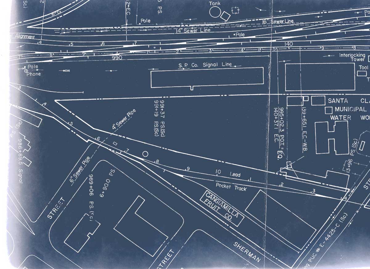
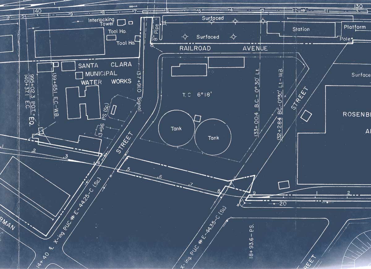
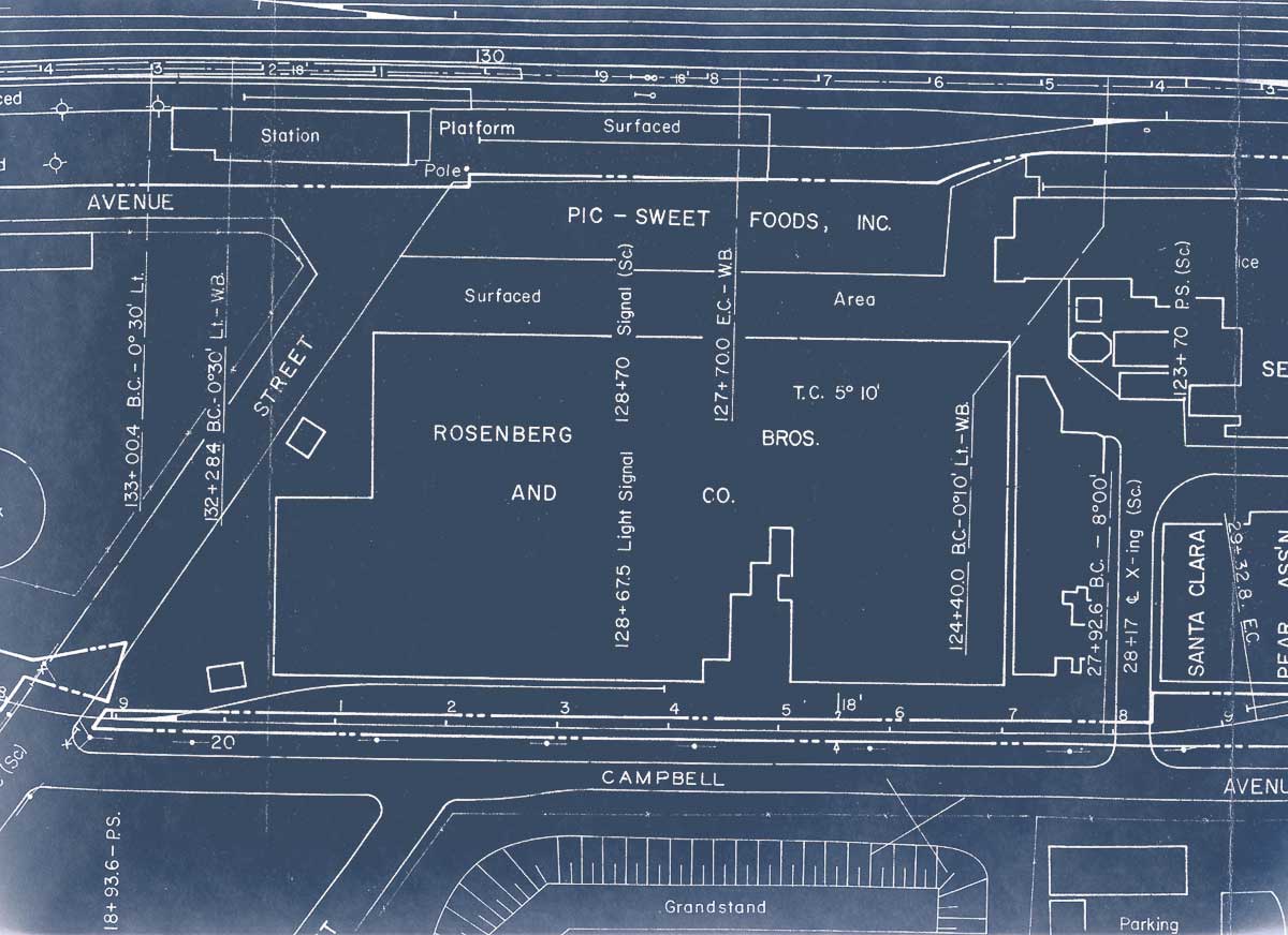
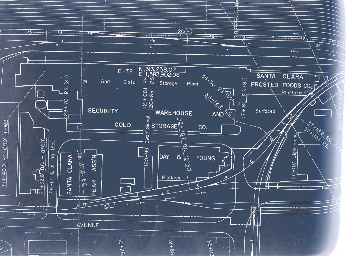
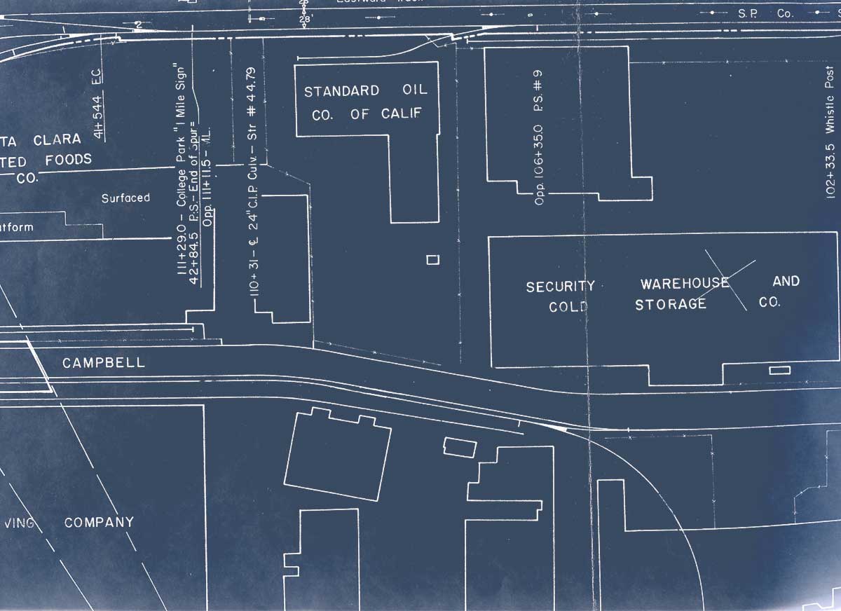
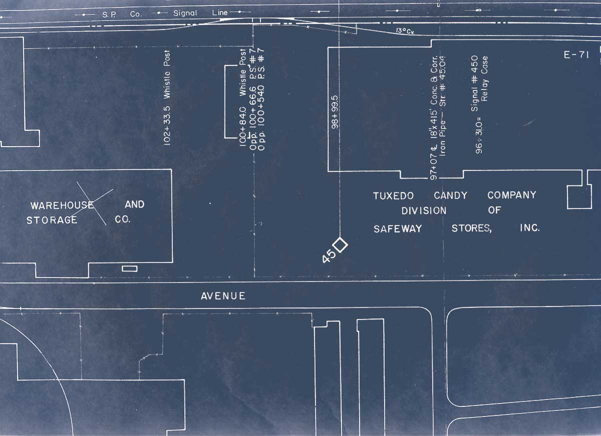
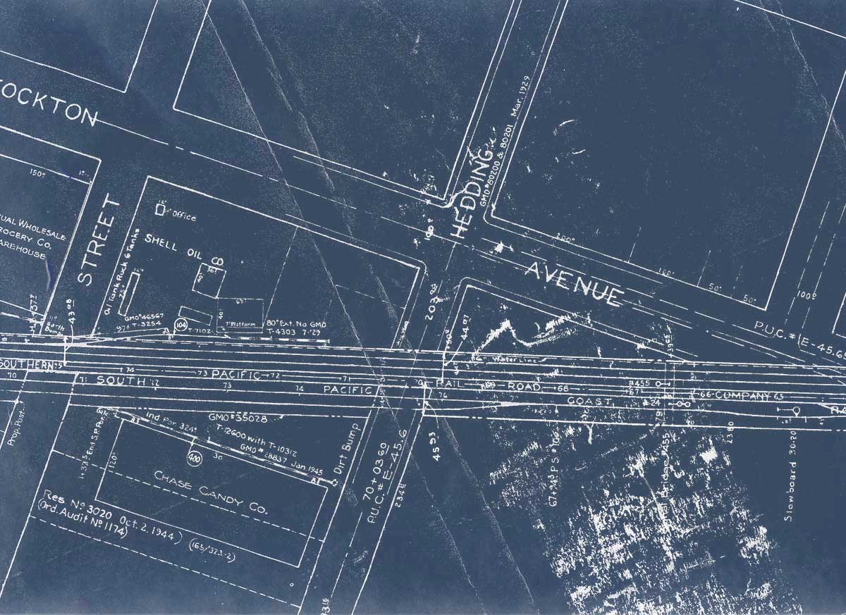
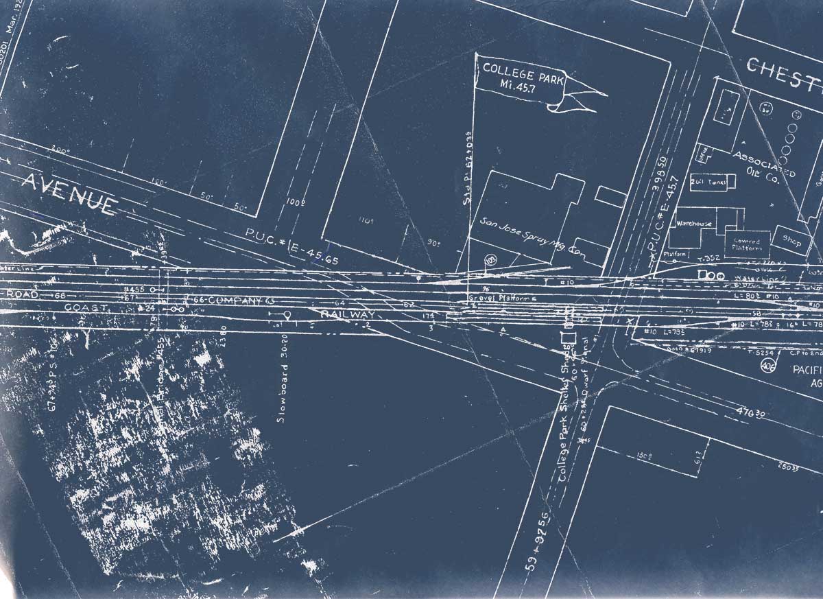
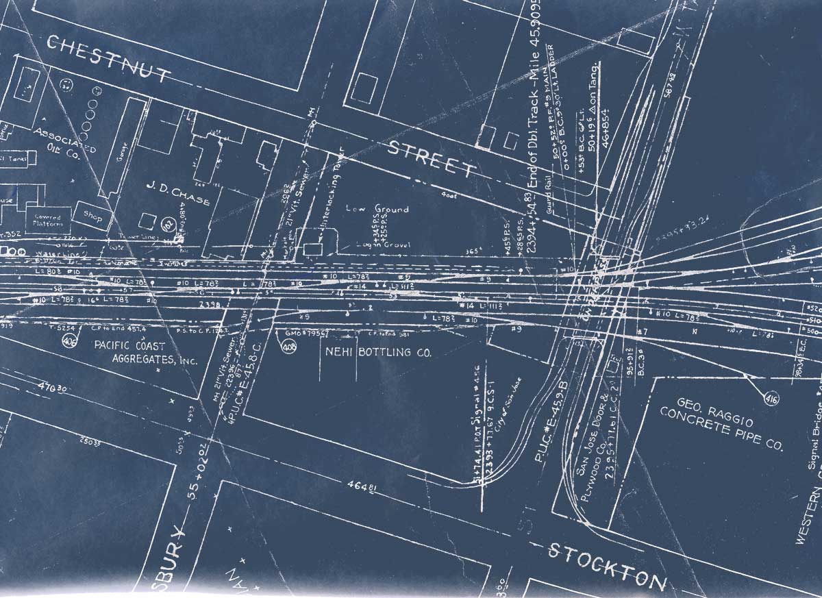
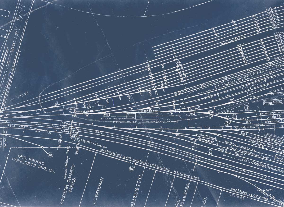
Note: Images are listed in order, from timetable west to east. sp_cahill_trackplan_head.jpg description Santa Clara to East End of Newhall St. Yard, 1967
Note: Images are listed in order, from timetable west to east. 1967sc2nh01.jpg Coast and Mulford Lines Junction |
|||
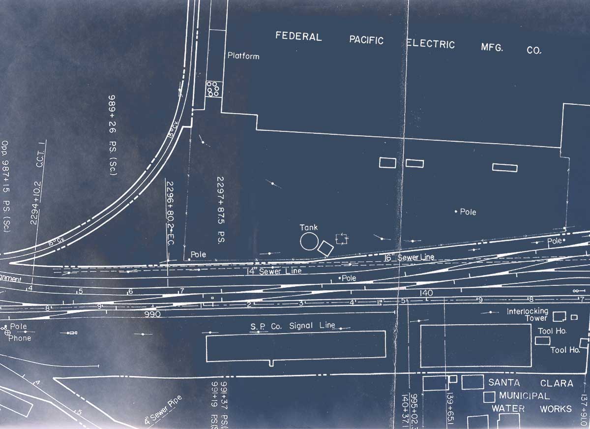
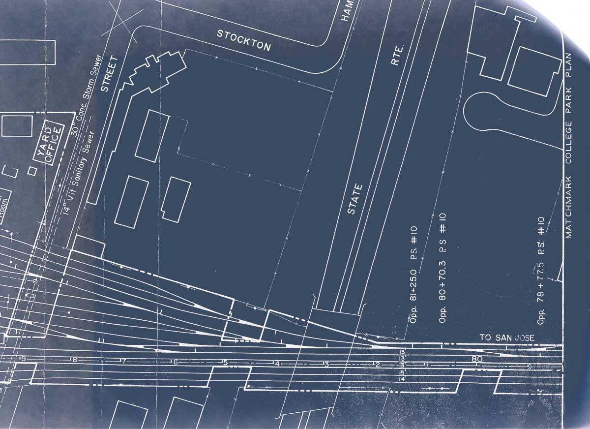
1932-01-27 San Jose Yard Limits map - showing all tracks xxxwithin yard limits; includes locations of various union pay arbitraries xxx- Shasta Division Archives 4-30-24 NEW: higher res PDF Newhall Yard to College Park, Lenzen Ave. R.H., 1958 (scans of selected portions, revised 6-27-19)
1958nh2cp01.jpg east of Newhall Yard throat |
|||||
|
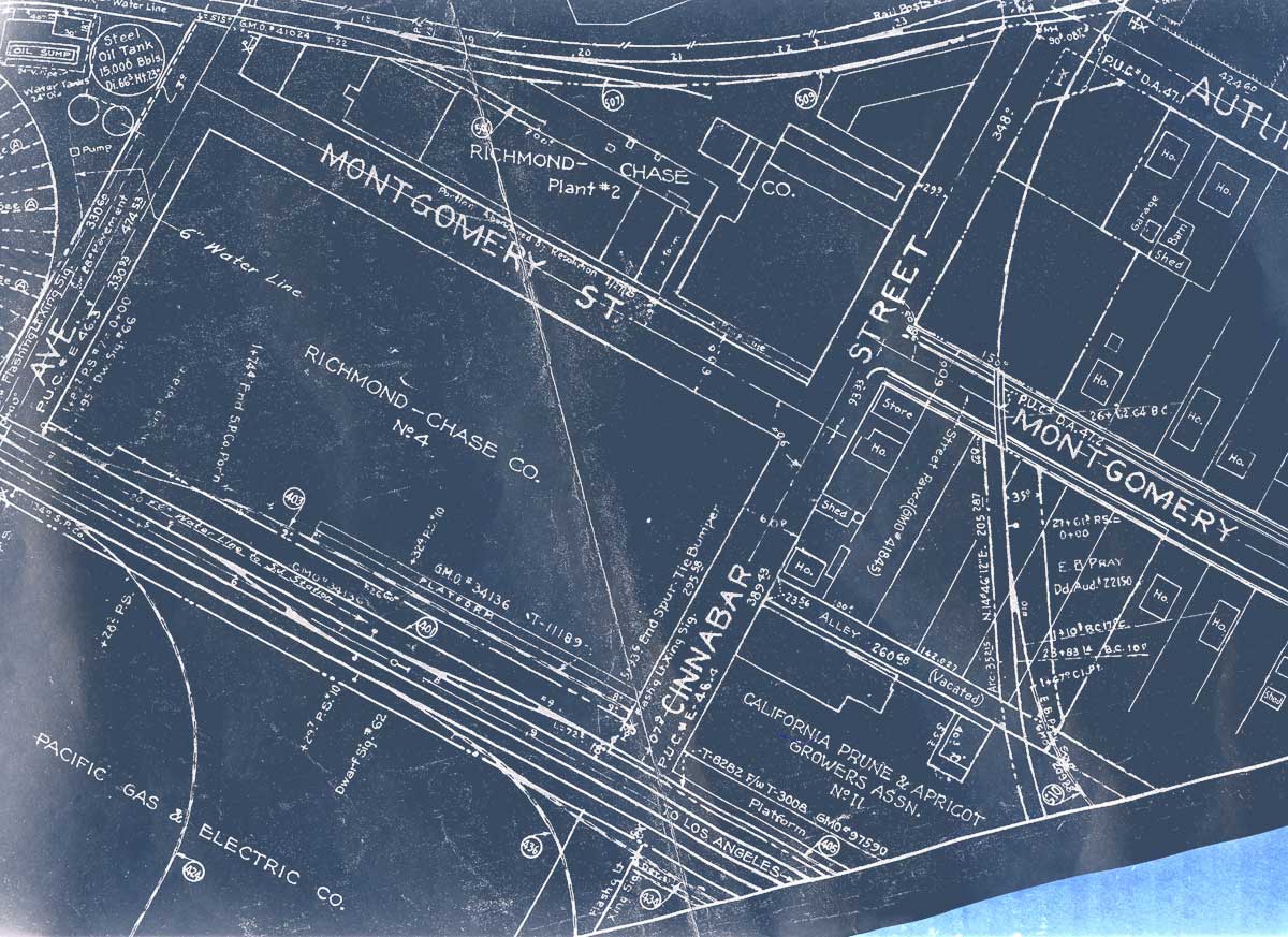
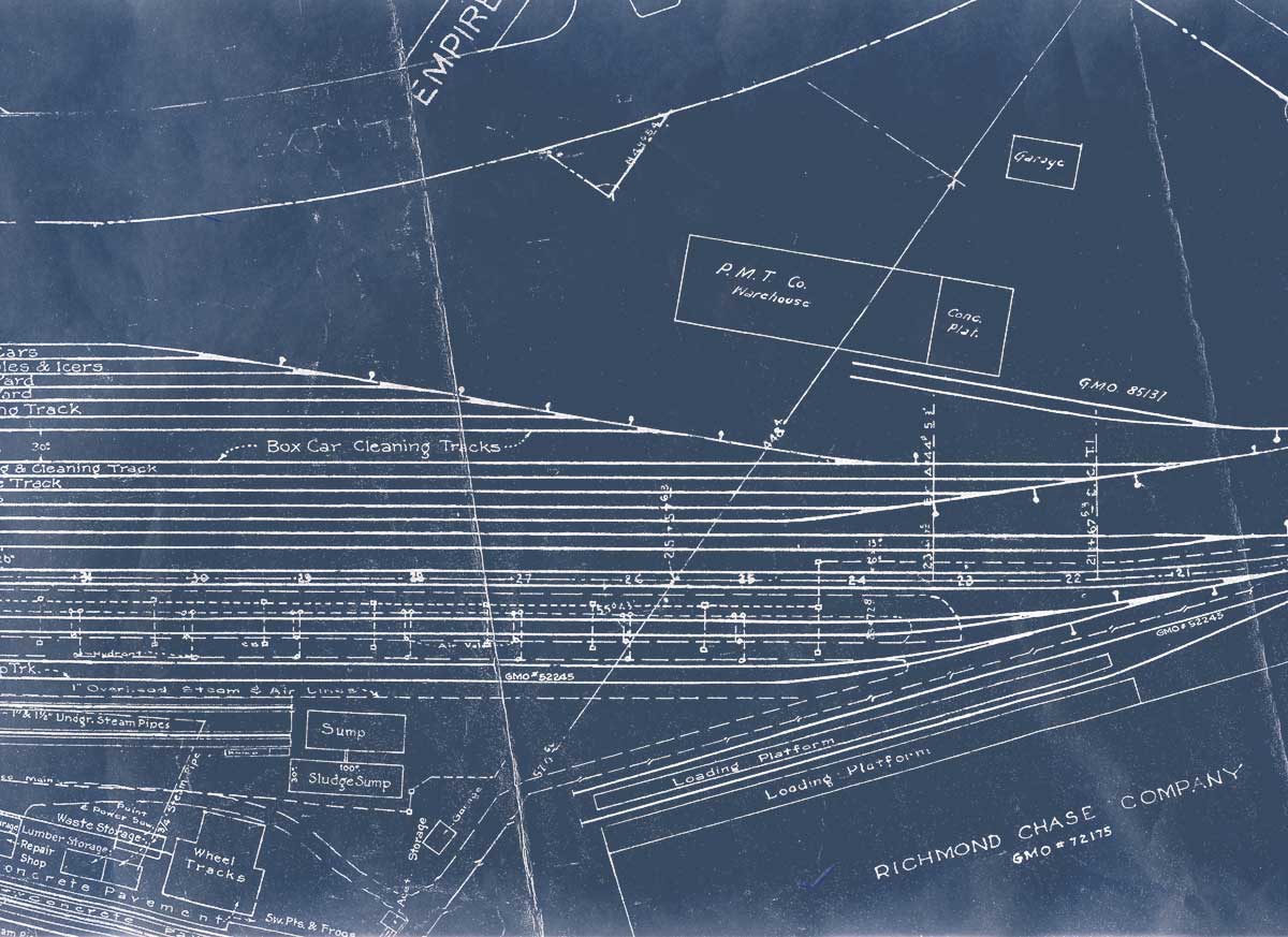
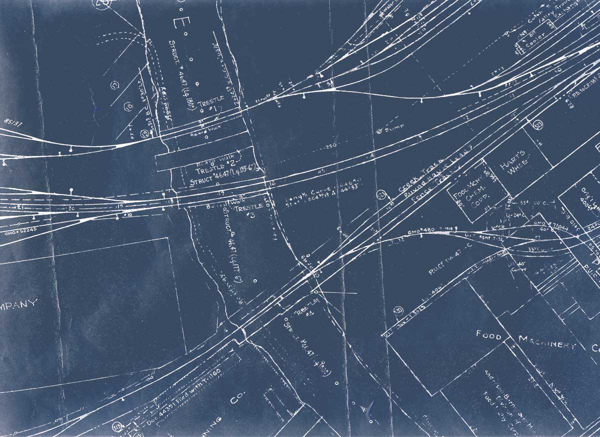
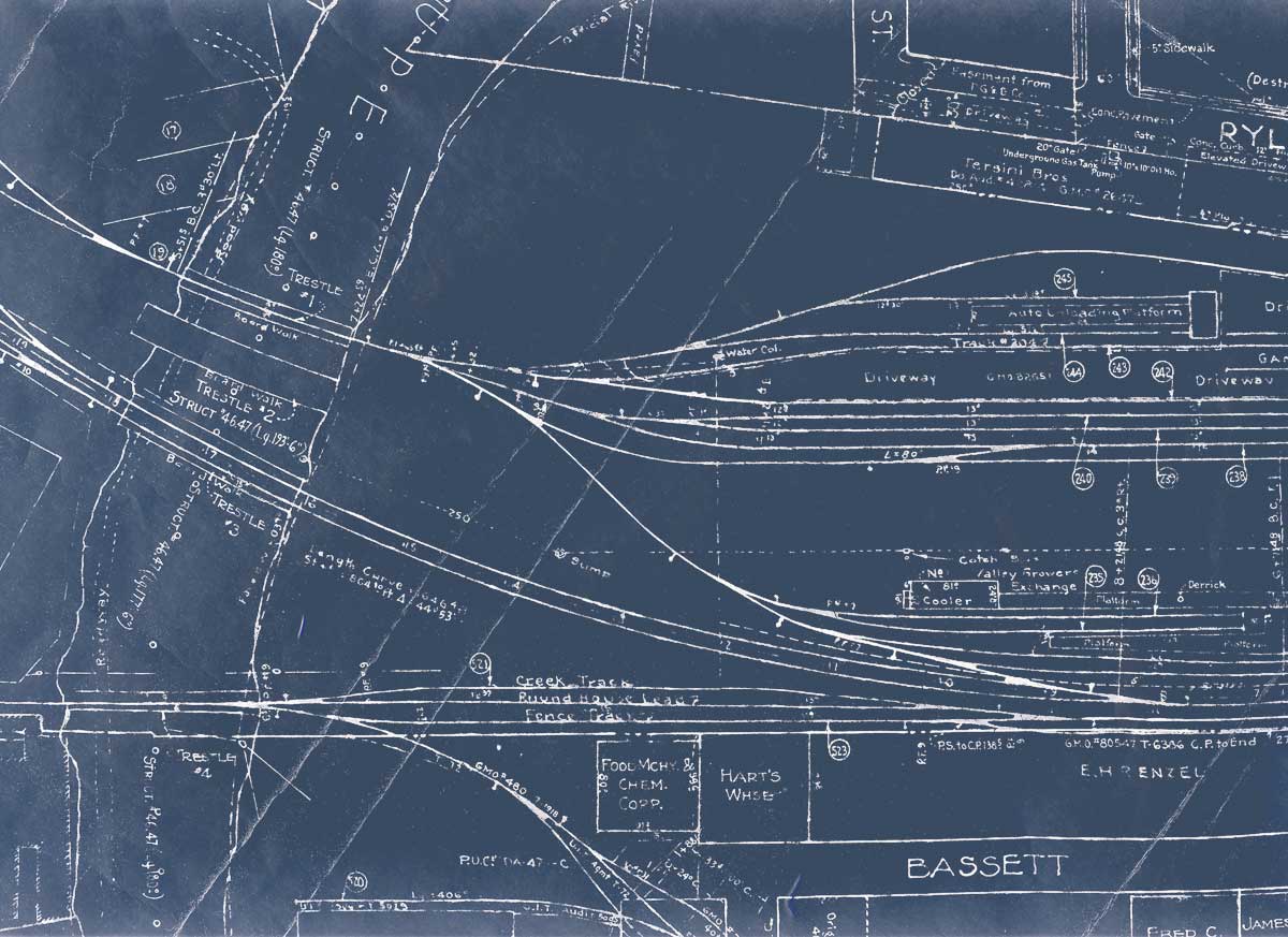
NEW 8-14-25: 1916-1931 Southern Pacific maps of major California & Oregon industrial areas Los Angeles, Los Angeles Harbor, Sacramento, Oakland-Alameda-Berkeley, Richmond, San Francisco and Portland |
|||||
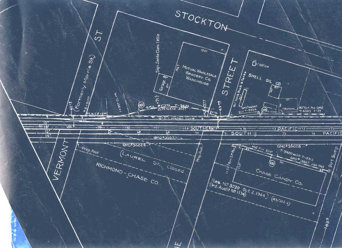
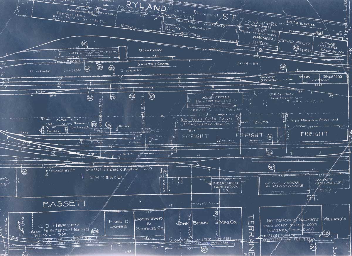
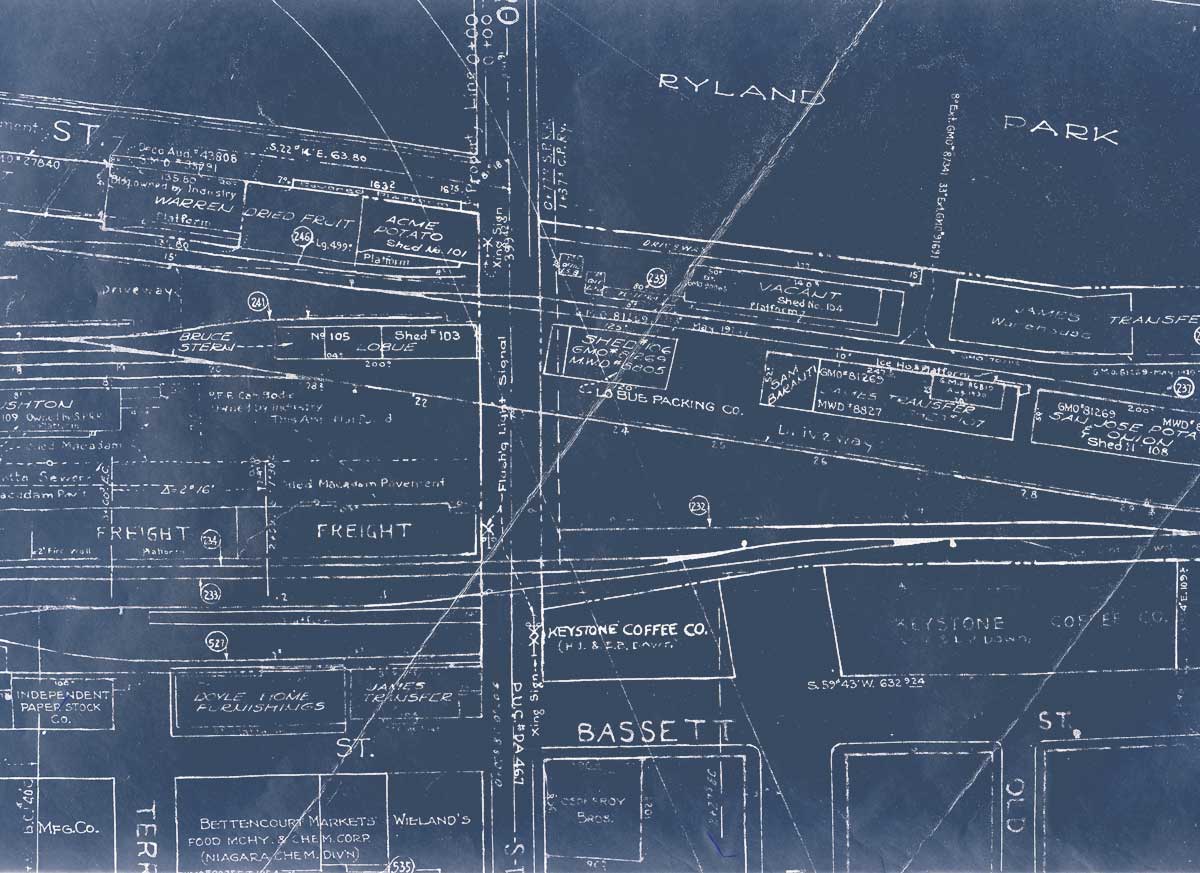
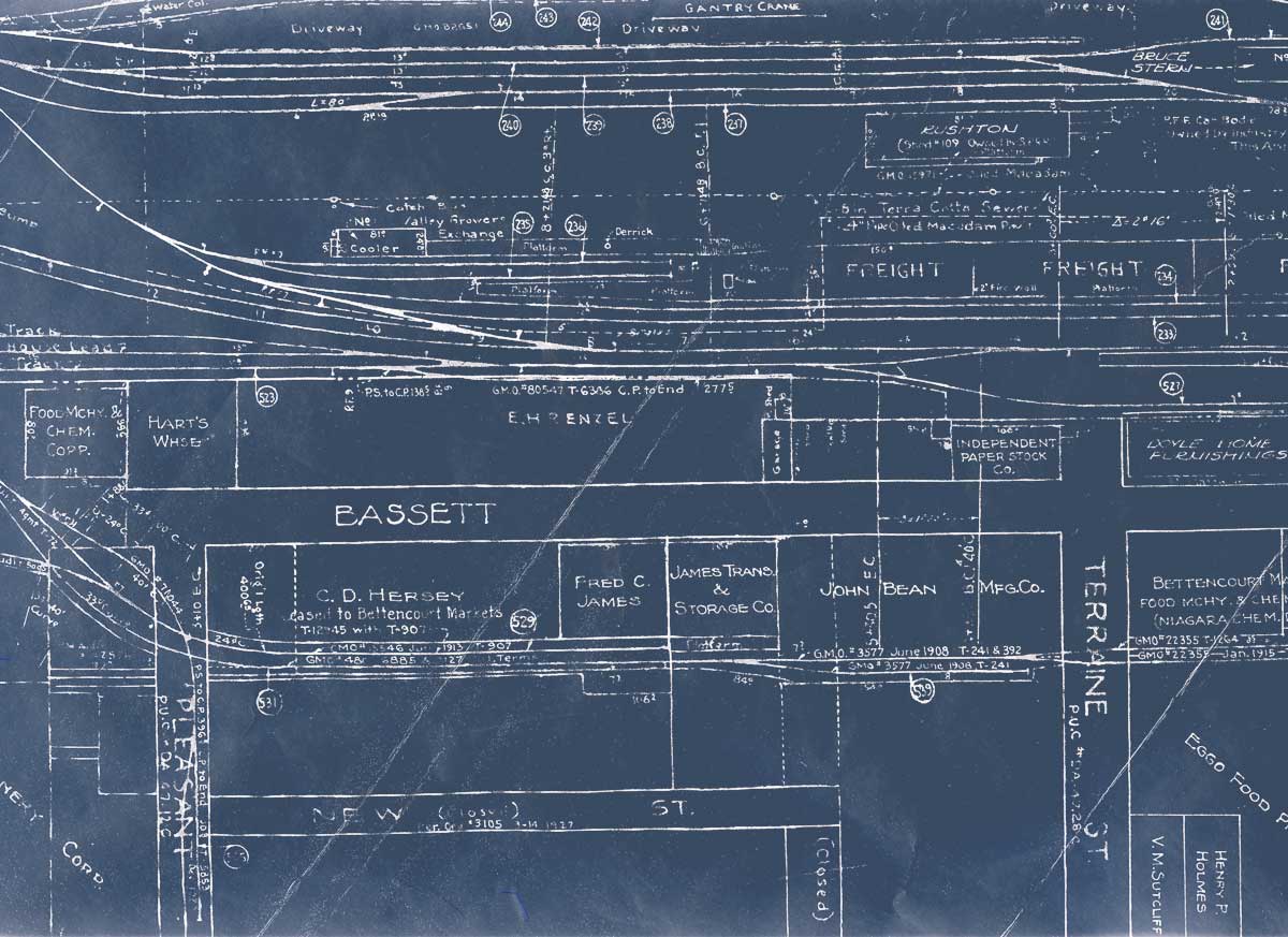
Portion of a drawing showing San Jose Old (1st) Yard taken from Coast Division, Santa Clara Valley drawings PDF, at upper page left - This drawing shows the remainders of the west end, with the "Old 4th St." mainline and yard leads heading towards the "New" yard, College Park Yard, at left. The ancient freight houses, which dated to the 1880's, at least, variously burned down, or were demolished in the 1970's. |
|||||