Clyde Underwood's 2018 Visit to West Hartley, Star and Empire Mines / Railroads
In the spring of 2018, Clyde Underwood and a friend took a mountain bike tour to the eastern-most of the Black Diamond mines / railroads. The photos and commentary below are all his.
He reports:
You can park at "Dallas Ranch Park" and bike down the road from the north. We saw motorcycles on the road, but mountain bikes are better, so you can go "off road" west towards the Starr Mine and West Hartley (yes, on private property, but no houses there - just cattle). Nice dirt roads, unlocked gates. The Starr Mine itself is just inside the park, but the railroad spur loading area is just east of it and down the hill - outside the park. We biked in and got busted by a cowboy, but wowed him with our 1896 map and stories, and he pointed out where the (freshly graded) dirt road would take us up towards the Starr mine loading area. Got some interesting coal samples at the loading area (see photos).
A spur was easily visible leading up to West Hartley. The coal mine shafts in West Hartley are sealed. They are shown on modern USGS maps. One is open for about 10'. You can see the miner's pick marks there (see photos). The large abandoned industrial looking stuff east of West Hartley is now the location of a huge feedlot, we were told by the cowboy. We went up to the Black Diamond park afterwards and took some shots of the Black Diamond right of way leading up to the main mine there. The very steep little canyon there had filled-in trestle work on the canyon wall. The park trails don't go there since it's sketchy, but we used the right of way map to figure out where it was. We didn't have time to investigate other tunnels and more right of way in the park. It's a very large area.
MAPS
Map #1 - You can access the area off the Empire Mine Rd., now closed to cars, but still open to biking & hiking. Zoom in on this [Google] map of Antioch.
Map #2 - The Empire Mine Railroad grade is easily visible just to the west of Empire Mine road. [Google]
Map #3 - I looked in vain for the large Empire mine tunnel near Empire Mine rd. It must've been filled long ago. Probably centered here.
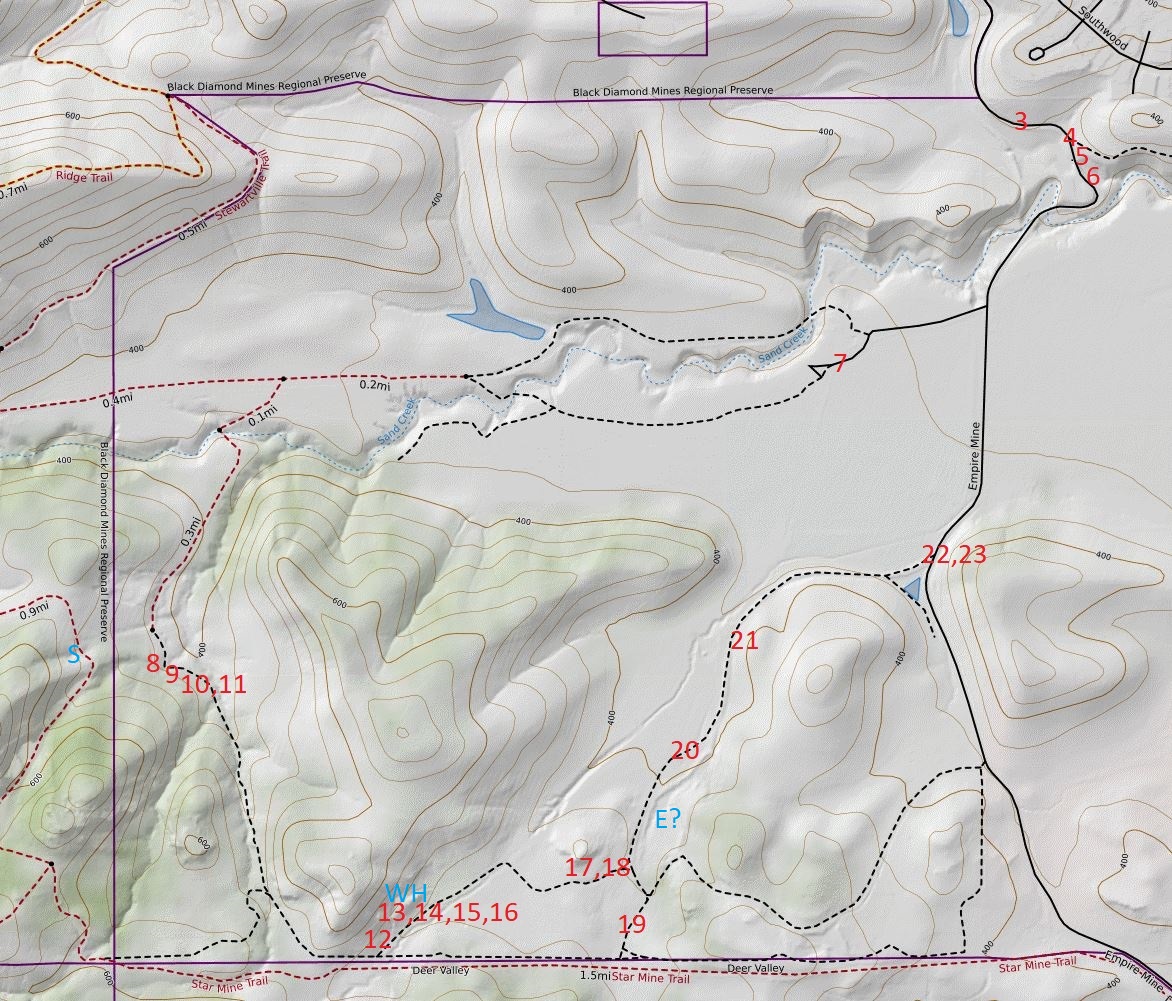
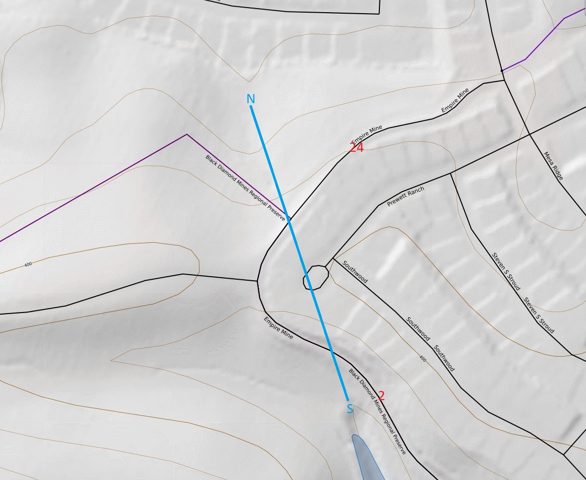
Map #4 - Empire Coal Mine Area; California topo map with "MapBuilder" preset.
xxxRed numbers designate picture locations
xxxBlue letters designate the following locations:
xxx"S" = Star mine
xxx"WH" = West Hartley
xxx"E?" = likely location of Empire mine
Map #5 - Empire Coal RR tunnel; California topo map with MapBuilder preset. See pictures #2 and #24
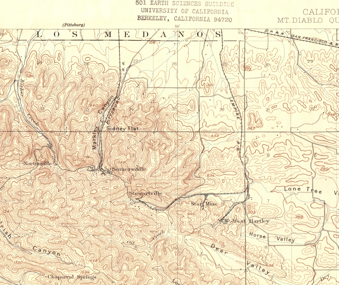
Map #6 - Section of historic 1898 USGS Mt Diablo quad 15' topo map.
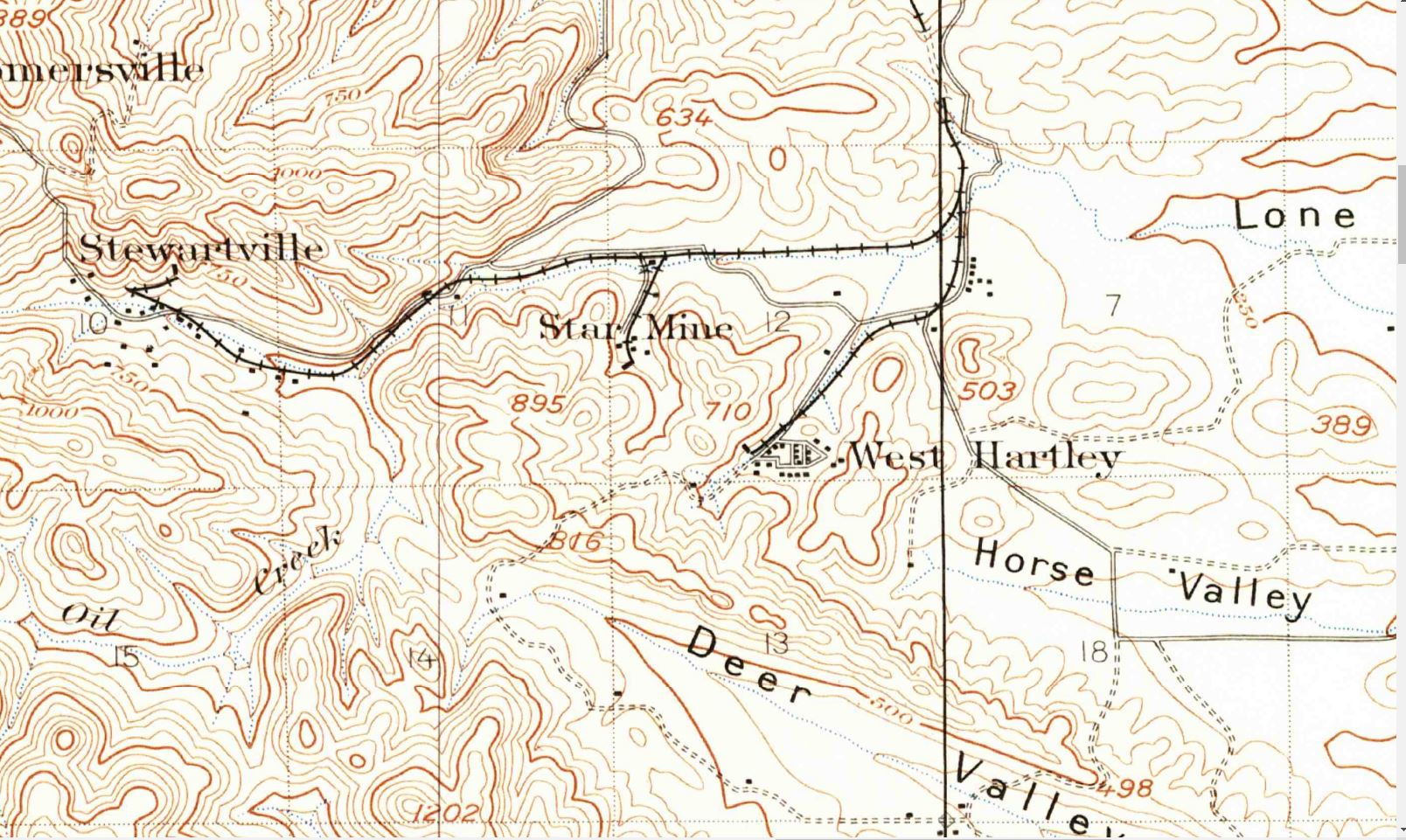
Map #7 - Same as Map #6, but zoomed in.
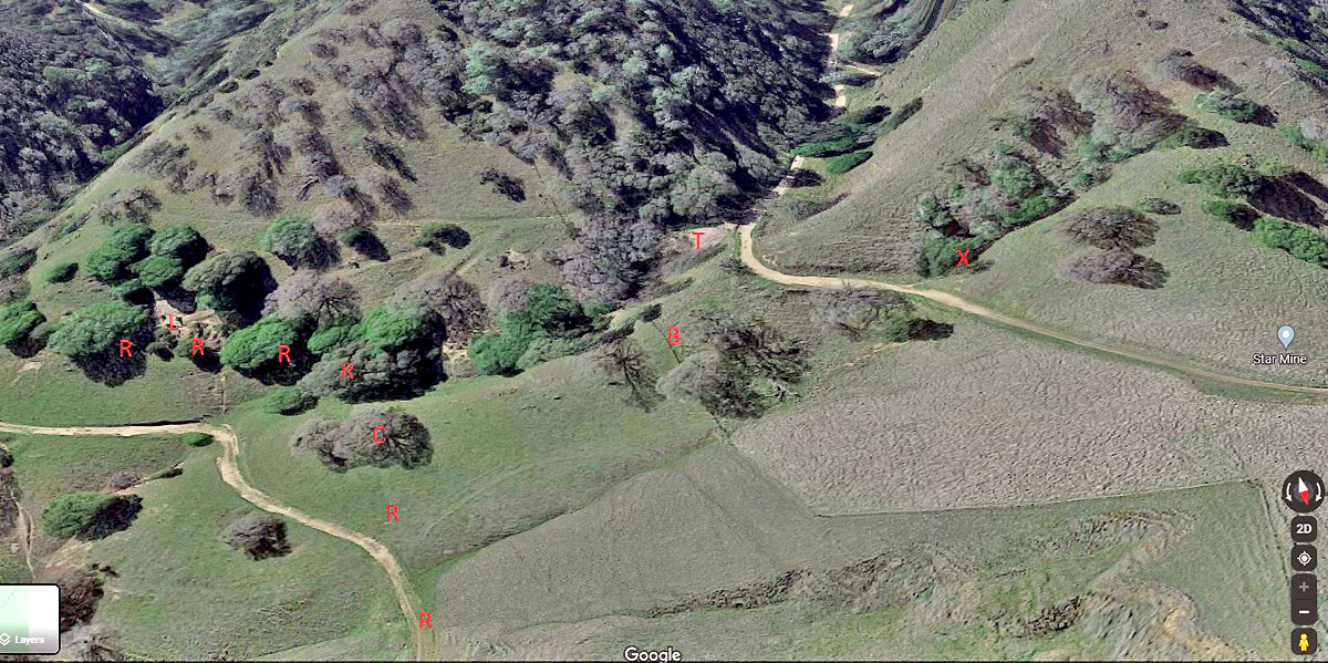
Map #8 - Google maps' satellite view (3D, looking south) of the Star mine area.
xxxR = Right of way for railroad spur to Star mine
xxxX = Actual location of Star mine
xxxC = Cut in hillside for right of way
xxxL = Loading area, probable location of coal bunker
xxxT = Tailings pile
xxxB = Boundary fence
Note the trails in the hillside above and to the right of the loading area. The top one was likely the path of a mine cart track.
Photographs
(click on the images for larger versions)
The pictures below, except the first, are from the area east of the Star Mine in the preserve, accessed via Empire Mine Rd. (no vehicle access, hiking & biking only). Note that this area is outside of the preserve. Each picture's location is called out with its number in red on Map #4, which serve as a legend.
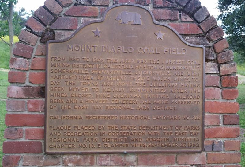
001- This plaque is near the parking lot for the Black Diamond Mines Regional Preserve in Markley Canyon at the south end of Somersville Rd in Antioch.
002 - View looking west from Empire Mine Rd and down at the location of the south portal of the 1000' tunnel of the Empire Mine Coal Mine railroad. See Map #5. There was no sign of any portal. It must've been closed up long ago.
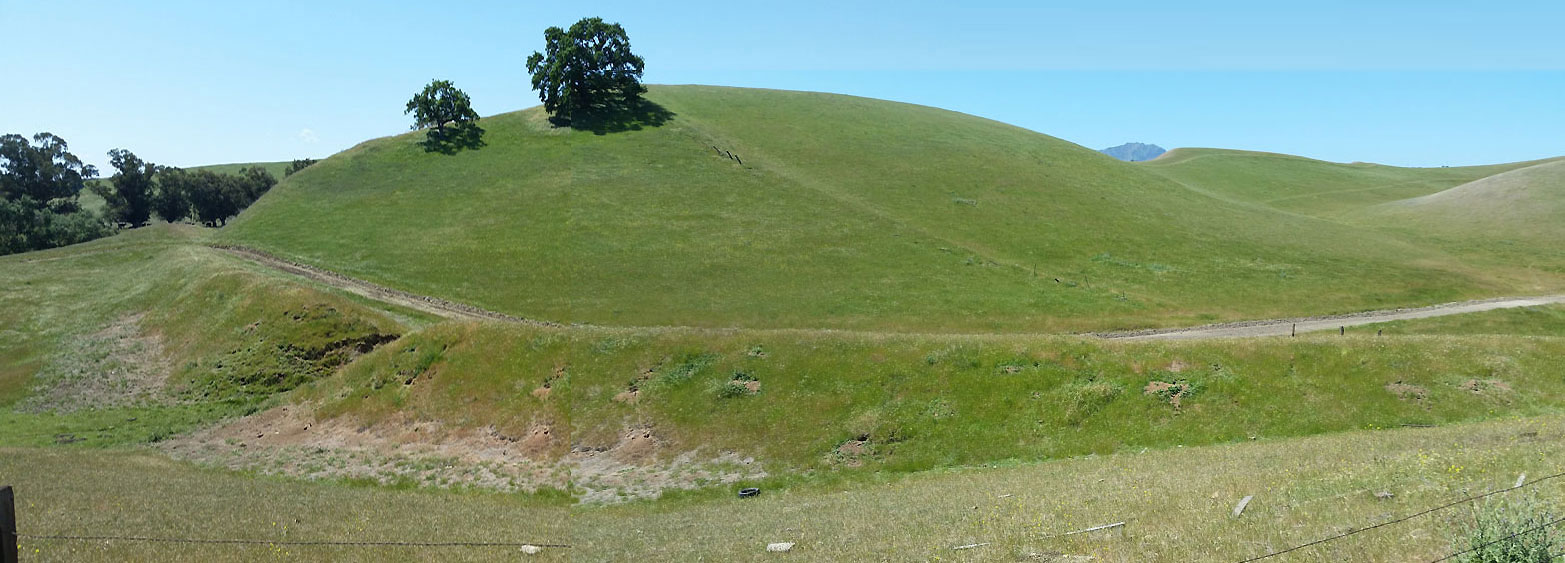
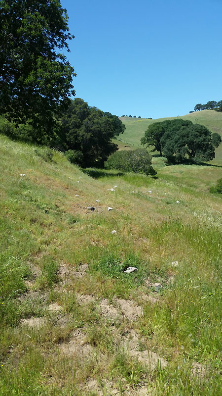
003-004 [panorama stitched together by Wx4] View looking south from Empire Mine Rd at the railroad right of way on a prominent embankment where it crossed a small creek. See Map #4 for the location of this picture as well as all subsequent pictures until picture 024. There were no pilings or other evidence of the small trestle that was once there. Note Mt Diablo peeking up in the distance.
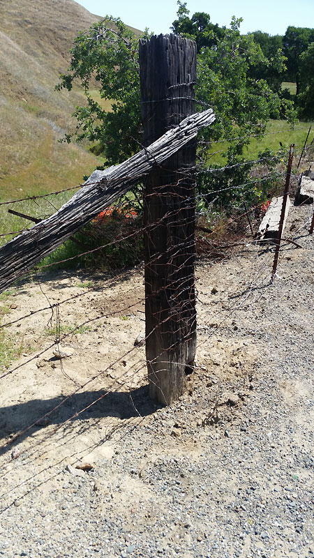
005 - View looking east from Empire Mine Road at one of the numerous railroad ties used as fence posts. It seems likely these could've been from the Empire Mine RR (sourced from Pt. Arena redwoods), and if so, they would now be 144 years old.
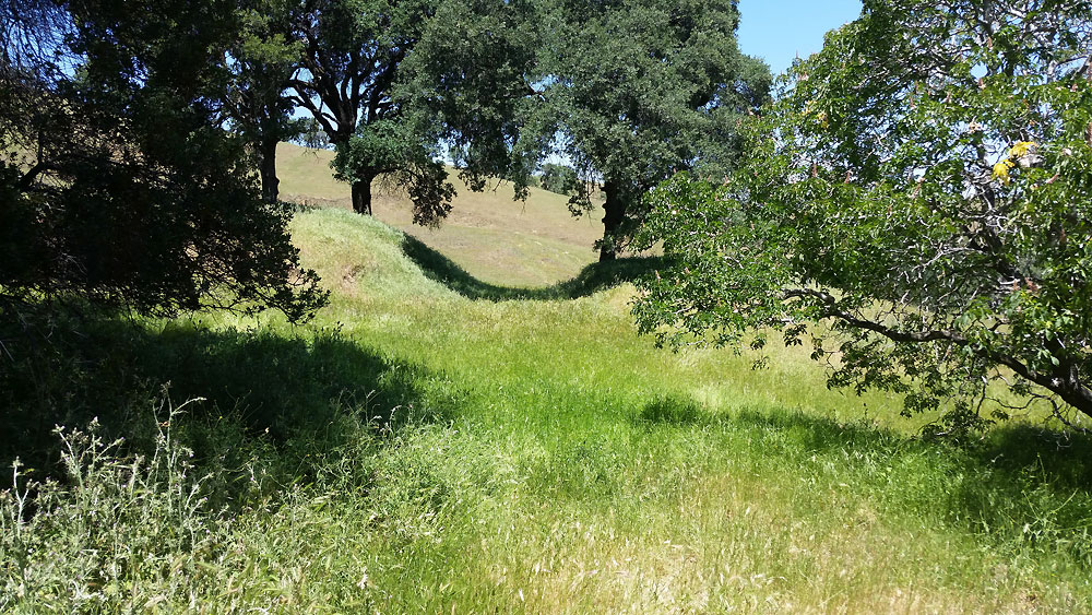
006 - View from Empire Mine Rd looking northwest at the railroad embankment showing the gap where the small trestle once was.
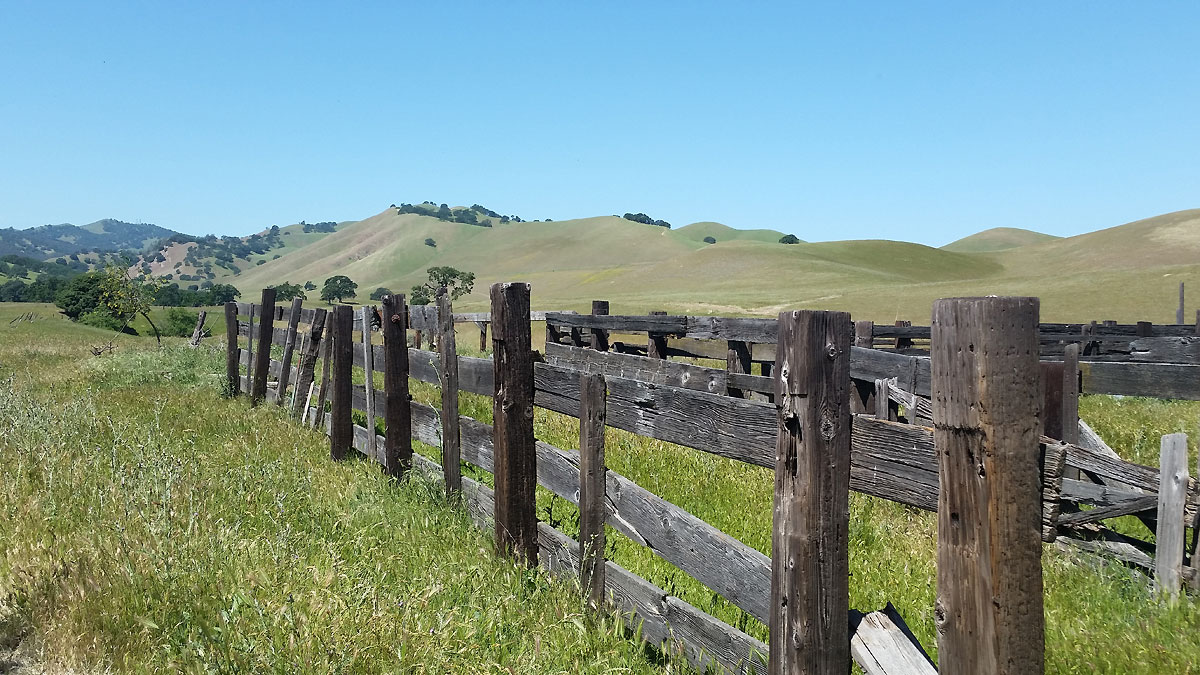
007 - View looking west at the corral fence near the gravel road just south of the ranch buildings, which are 500' west of Empire Mine Rd. The buildings have been mostly burned up (see Google maps satellite view), but this area is still an active cattle ranching area with the gravel and dirt roads fairly well maintained.
I believe the railroad used a long trestle to cross the creek and come down to the area near the junction of Empire Mine Road and the road to the ranch. This was the location of a switch that led west to Stewartsville and a spur to the Star mine. I suspect the road to the ranch is the right of way. See Map #2 and Map #7; The right of way on the topo looks significantly different than its likely route on the satellite view, probably because of 140 years of erosion.
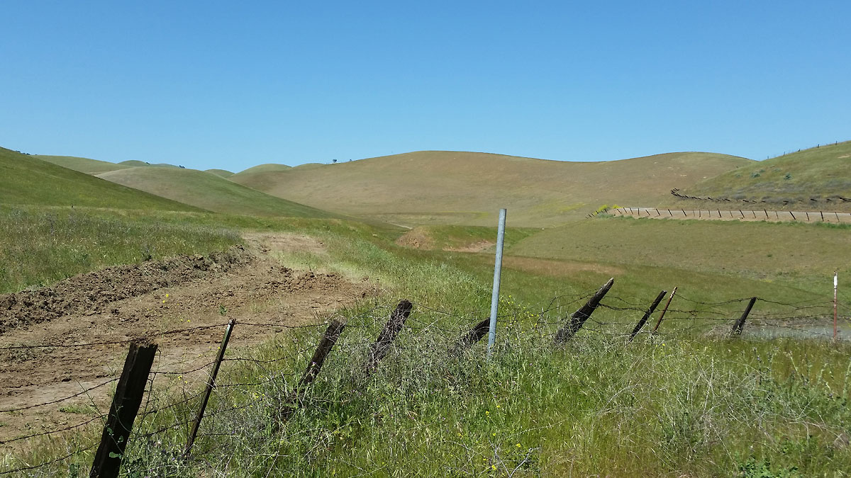
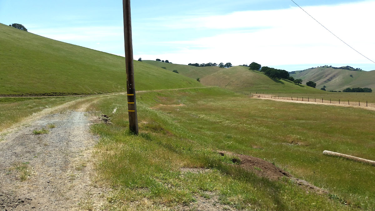
008 - View looking due north at a small cut in the spur right of way going up to the Star mine loading area. On the north side of the cut (in the distance) after about 60-70' the right of way merges with the existing dirt road. To your back in this view the right of way continues to go up and gradually turns to the east. See Map #7.
In Map #8, a Google satellite view, the right of way on either side of the cut is just visible. As it turns to the east, the satellite view of the right of way is completely obscured by trees About 150' southeast of the cut you can see in the satellite view a rocky area above the ROW which must've once had the coal bunker and loading area for the railroad tracks down below it.
It turns out the Star mine itself is 500' west and uphill from the loading area. You can see several 'trails' to the west of the bunker area which were likely mine cart tracks which went to the bunker. The trails are readily apparent in Google 3D satellite view.
Google maps incorrectly labels the location of the Star mine. It is actually about 300' south of the label on the map. If you hover the little yellow "street view man" near the Star mine label, you'll see a blue dot indicating the actual location of the mine and a really nice photo sphere view of the (barred) entrance to the Star mine, just to the west of the Star Mine Trail.
BTW, the spur right of way to the Star mine is a dirt road for much of the way north from where the it merges with the road. When it approaches the large creek, the road make an abrupt turn down to the creek bed and up and over to the other side. When we initially turned off the main right of way and started going south on the spur, we were down in the creek bed where we took a quick look at where a trestle over the creek must've been, but there was no evidence of pilings or even embankments there.

009 - View looking southeast on the ROW going to the Star mine loading area.
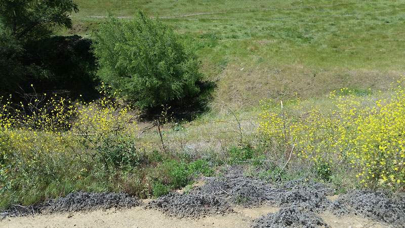
010 - View looking northwest from the Star mine loading area. Note the rocks. Small chunks of jet black coal were pretty easy to find. Larger samples had streaks of black coal in them, but also lighter colored rock.
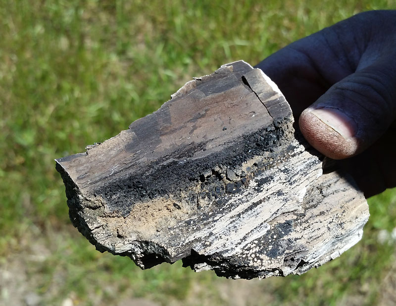
011 - Rock/coal sample from the loading area.
Note that these 4 pictures, 8,9,10 & 11 are actually located on the ROW up above the dirt road by about 50'. The dirt road on Map #4 is colored black. The location where the dirt road's color changes from red to black is where the dirt road diverges from the ROW. The ROW is not shown on the map from that location south.

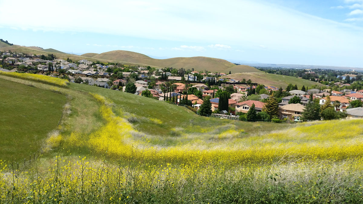
012 - View from above the dirt road on the way to the West Hartley mine. Central valley in the distance. The West Hartley mine is just around the corner to the left.

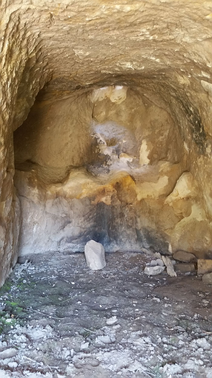
013 - View looking northwest at the West Hartley mine entrance. It was obviously dynamited closed many years ago.
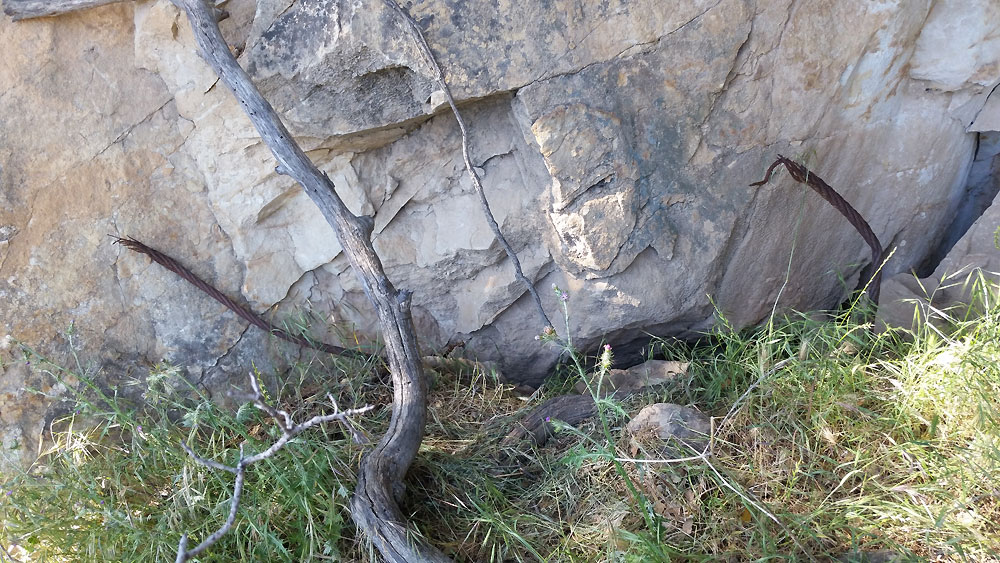
014 - Closeup view of the West Hartley mine entrance. Note the massive steel cables. The mine location is labeled on modern USGS topo maps as "Coal mine tunnels".

015 - View looking east at brick foundations near the entrance to the West Hartley mine.
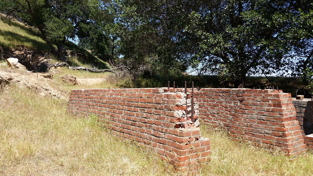
016 - View looking north at brick foundations near the entrance to the West Hartley mine. The foundations likely supported hoisting machinery. To the right of the foundations and over the rise is the massive tailings pile from the mine, easily visible in Google satellite view.
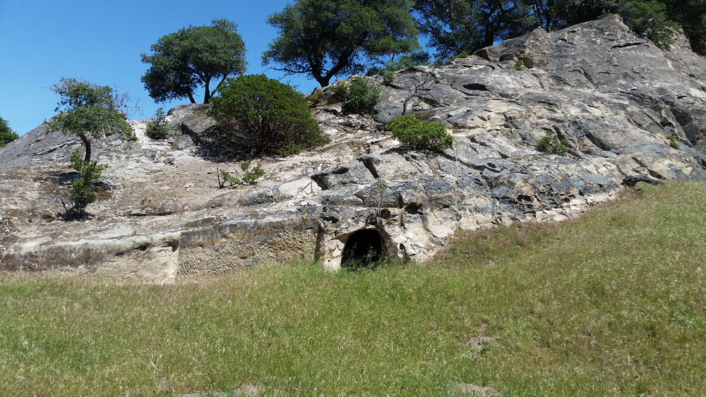
017 - View of large rocks looking north from the dirt road heading northeast from the West Hartley mine. This was a lengthy trek through the grass, but it was only a small test (?) tunnel about 10' long into the rock. The area just to the left of the tunnel was clearly cut out by hand picks. Not sure what its purpose was, but it wasn't a coal mine.
018 - View from inside the small tunnel. You could easily stand up in it, and I think there may have been a "chimney" opening at the rear to allow smoke to go up and out. It was interesting looking at the rock which had pick marks made by the men who made the tunnel.
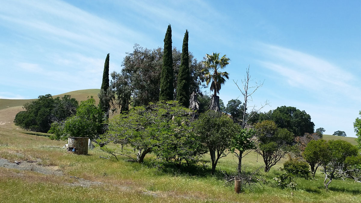
019 - View looking northwest at evidence of long ago residents of West Hartley. From the cypress and palm trees, there must've been houses here once. Those are probably old fruit trees also. This area is easily spotted in Map #8 via the shadows from the cypress trees.
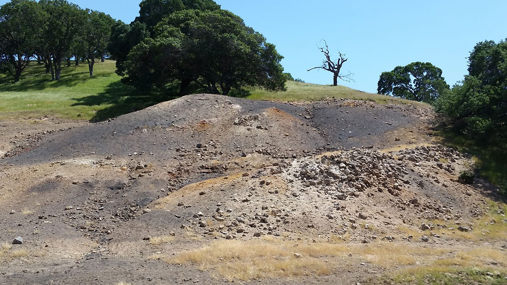
020 - View to the southeast from the dirt road going north from West Hartley. This massive tailings pile is likely from the Empire mine. We did not have time to try to find the mine opening. From the description of the Empire mine in the Ward pamphlet and the amount of coal removed, it seems most likely this is the Empire mine, however there was apparently also a Hartley (not West Hartley) mine. Google satellite maps only shows 2 big tailings piles in this area, the one at the West Hartley and this one.
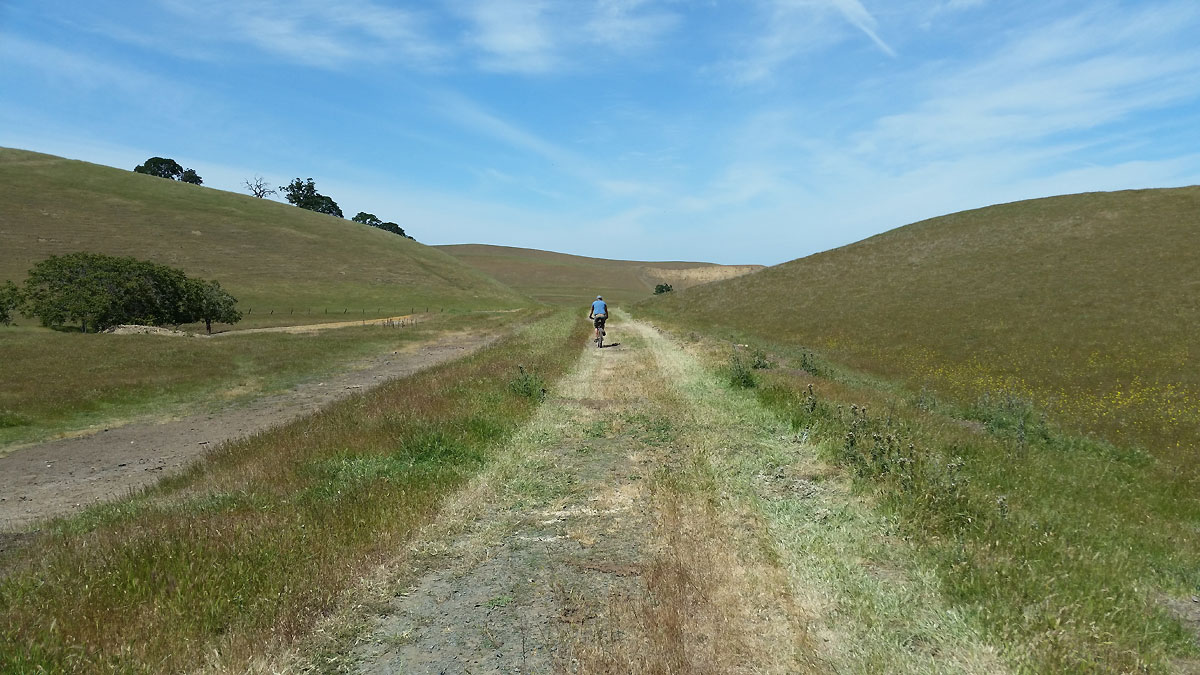
021 - View to the north on the dirt road going north from West Hartley. From the slope on either side of the road, it is clearly a railroad right of way. The Ward pamphlet has a map which shows a spur which would be in this location coming off the spur going to the West Hartley mine. The end of that spur is labeled "Empire shops".
022 - View to the west from the road which leads to West Hartley from Empire Mine Road. This is clearly a railroad right of way.

023 - View to the west on the same road as in the above picture, but eastward on the other (east) side of the gate.
024 - View to west from Empire Mine Rd. See Map #5.
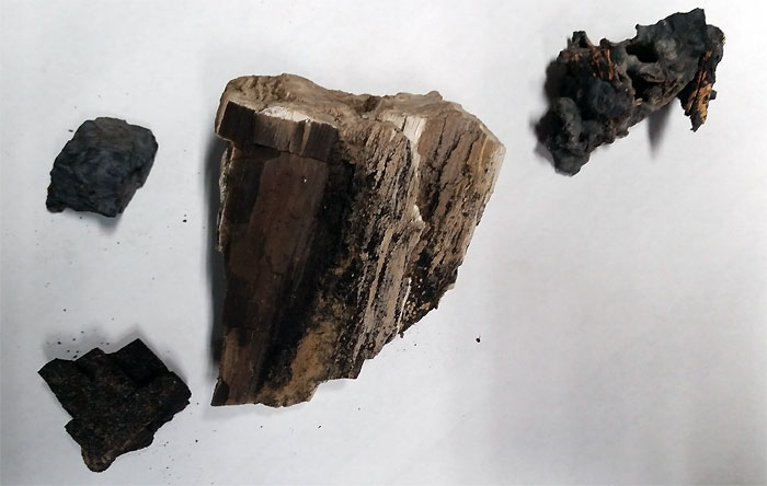
025 - Coal/rock samples from the Star mine loading area.

